It is 2:14 p.m. somewhere in West Texas. A drone the size of a small dog rises over a sea of solar panels, points a thermal camera at the rows, and starts counting heat signatures it should not see. By the time it lands, a software platform two thousand miles away in Massachusetts has already flagged 312 underperforming modules, ranked them by lost watts, and dropped them on a technician's task list. The technician will fix the worst of them before dinner.
The platform is Raptor Maps. The technician has probably never met the people who built it. That is more or less the point.
Who They Are, Right Now
Raptor Maps sells software to the unglamorous middle of the energy transition: the people who own, operate, and maintain hundreds of utility-scale solar plants. Its product, Raptor Solar, behaves a bit like a hospital's electronic health record - except the patients are 86 million solar modules spread across six continents, and the symptoms include thermal hotspots, cracked cells, snail trails, vegetation creeping up combiner boxes, and the occasional very surprised coyote.
The company is roughly 86 people, headquartered above a row of triple-deckers on Somerville Avenue, with engineers scattered everywhere from Boston to Bangalore. It has $63.9 million in venture funding, a Series C closed in December 2024, and the kind of customer list - global IPPs, OEMs, O&M shops - that gets quoted at industry conferences but rarely at dinner parties.
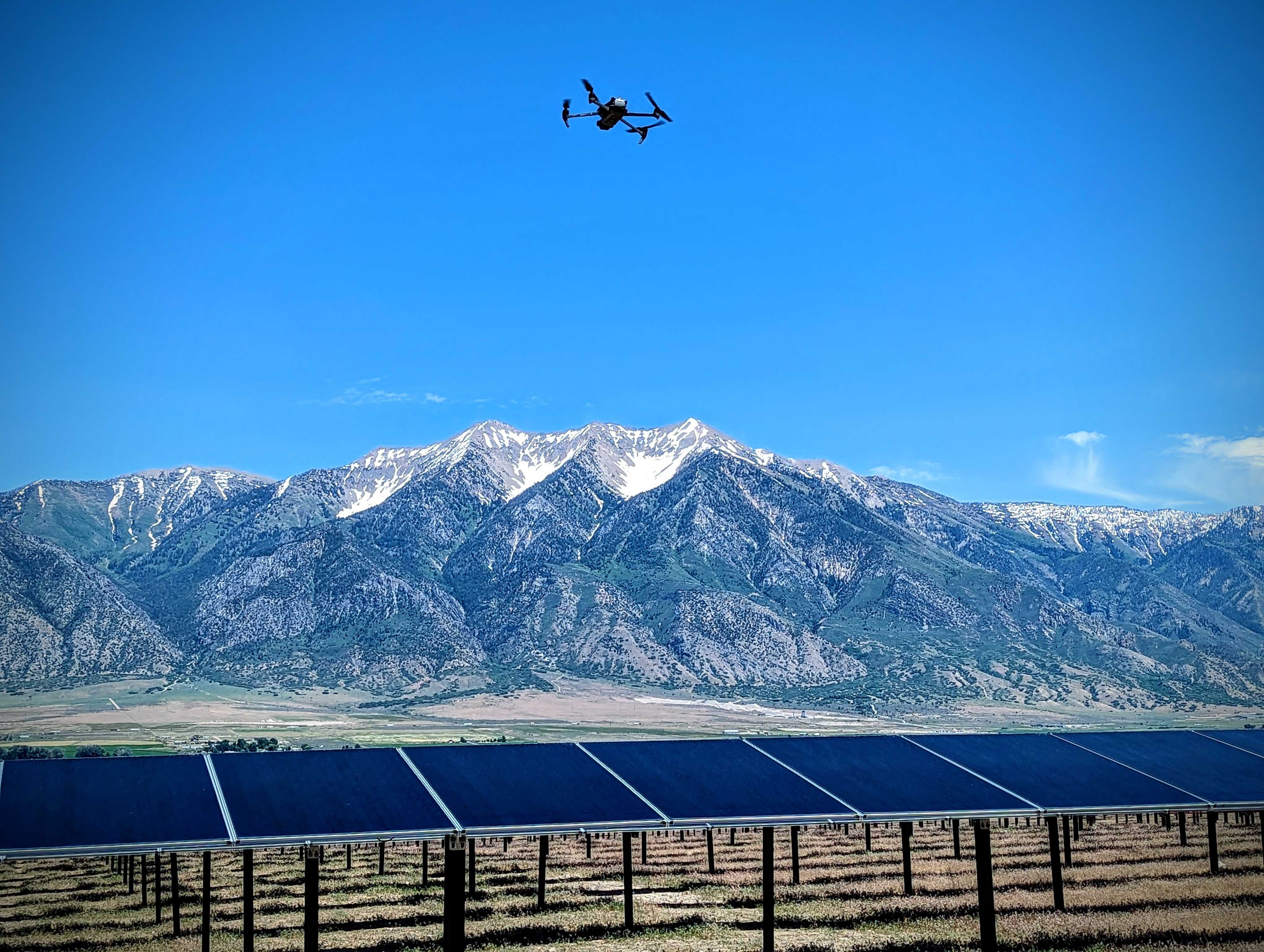
Above: a drone over a Raptor-managed array. Below: an industry quietly betting that better software, not bigger panels, is the next decade's edge.
The Problem They Saw
For about a decade, the renewables story was a construction story. Capacity went up. Module prices went down. Anyone with a checkbook and a desert could build a power plant. Then the bill arrived.
A 500 MW solar farm has about 1.4 million panels. Each panel can fail in dozens of ways. Inverters trip, fuses pop, soiling builds, junction boxes overheat, and warranties get argued about. The spreadsheets that ran the first wave of solar collapsed under the weight of the second. Owners started discovering that 2-5% of their nameplate capacity was simply missing - and nobody could tell them which panels were to blame.
Enter three MIT students with a drone
Nikhil Vadhavkar, Eddie Obropta, and Forrest Meyen met in the Man-Vehicle Laboratory at MIT - the same lab that helped train Apollo-era astronauts to keep their lunch down. Their first idea, charmingly, was drones for agriculture. The pivot to solar was less romantic and more arithmetic: solar plants are large, flat, gridded, and contain expensive things that get hot when they break. Drones are very good at finding hot things on flat grids.
In 2015, the team won MIT's $100,000 Entrepreneurship Competition. Y Combinator picked them up. They spent the next several years figuring out what hindsight makes obvious: the drone was never the product. The product was the data the drone produced, and the software that turned a thermal image into a maintenance ticket.
The Founders' Bet
The bet was simple, and against the grain. While most hardware startups doubled down on the flying camera, Raptor Maps doubled down on the database. They built a digital twin: every plant, mapped to the millimeter, with every panel, string, combiner, inverter, and transformer assigned a unique identity. Then they let other people fly the drones.
It was a deeply unfashionable choice. Investors at the time wanted hardware moats. Customers thought they wanted nicer pictures. What they actually wanted, it turned out, was a single place where every photograph, sensor reading, warranty claim, and field note could finally agree on which panel was which.
A Modestly Eventful Decade
Founded at MIT. Wins $100K Entrepreneurship Competition.
Joins Y Combinator. Pivots from agriculture to solar.
Raises $5M Series A, co-led by Blue Bear Capital.
Raises $22M Series B from MacKinnon, Bennett & Co.
Crosses 50 GW of assets under management.
Closes $35M Series C, led by Maverix Private Equity.
71+ GW under management. Operations on six continents.
The Product, In Plain English
Raptor Solar is a cloud platform that does four things, in roughly this order: it ingests data, normalizes it, finds what is wrong, and tells the right person to fix it. None of those steps are individually new. Doing all four in one place, for a 5 GW portfolio that bought equipment from twelve different vendors over a decade, is. The platform fuses drone thermography, SCADA performance data, on-site sensor readings, field-technician checklists, and warranty paperwork into a single source of truth. Customers can sit in a Boston conference room and zoom from a continent down to a specific cell crack on a specific module in Texas in about three clicks.
There is also a robotics layer - vegetation-management bots, autonomous drones, inspection rovers - that increasingly takes its orders from Raptor Solar. The pitch is unglamorous and entirely the point: instead of hiring more people to walk more rows, you point machines at the rows and reserve the humans for the fixes that matter.
Funding by Round
The Proof
Software companies love to claim they are "the operating system" for an industry. It is the climate-tech equivalent of a startup naming itself after a Roman god. Raptor Maps gets to make the claim with slightly more support than most: 71 gigawatts is not a marketing number. It is, roughly, the entire installed solar capacity of Germany, sitting inside a single product.
The customer list reads like the boring end of an energy conference: utility-scale owners, independent power producers, O&M providers, and module OEMs. None of them are particularly excited about telling the world they buy software. They are, however, increasingly excited about telling the world how much money they have stopped losing.
The Mission
Officially: "the digital foundation for a more scalable and resilient solar industry." Unofficially, and more usefully: make sure the panels you already paid for actually produce the electricity you were promised.
There is a quiet climate argument inside this. Every megawatt-hour clawed back from a misperforming array is a megawatt-hour that does not have to be generated somewhere else, usually by something that burns. Raptor Maps' customers care about that, but they are mostly motivated by something much older: their warranties, their lenders, and the spreadsheets that finance the next plant.
Why Tomorrow Looks Different
Solar capacity is on track to roughly triple this decade. The number of qualified technicians is not. The amount of equipment under warranty is exploding. The number of OEMs willing to be reasonable about those warranties, history suggests, is finite. Somewhere in the middle of all of that, a software layer that knows every panel by name becomes less of a nice-to-have and more of an actuarial necessity.
Raptor Maps' Series C deck reportedly leaned heavily into AI - anomaly detection, predictive maintenance, automated reporting. Most of which the company has been doing for years. What is new is the volume of training data: nine years of inspections across 71 gigawatts is the kind of dataset that takes a long time to copy and a longer time to catch up to.
Which brings us back to West Texas. The drone has landed. The technician's phone has buzzed. Somewhere on Somerville Avenue, a piece of software you have never heard of has done its quiet, useful job - and the lights, against odds that get longer every year, stay on.
That, more or less, is the company.