A ladybug is an unlikely ambassador for enterprise software. Yet Taranis invites visitors to consider the spots on its back: the company says its aerial imagery is sharp enough to count them. It is a charming boast with a serious purpose. A field viewed from the road offers a reassuring wash of green. A leaf viewed closely can offer evidence of insects, disease or an unsuccessful weed treatment. The distance between those two views is where Taranis does business.
- The service: aerial scouting, AI crop analysis and agronomic recommendations.
- The route to market: agricultural retailers and their trusted advisors.
- The new calculation: estimated corn bushels at risk from specific threats.
Its customers are agricultural retailers and advisors; the eventual beneficiary is the grower trying to protect a crop without buying an unnecessary intervention. Taranis reports more than three million subscribed acres and over 100 global customers. Those are company figures. They describe a service operating at substantial scale, though they tell us little about what any particular farmer should expect to earn.
A leaf with a balance sheet
Founded in 2015 by Ofir Schlam, Eli Bukchin, Asaf Horvitz and Ayal Karmi, Taranis brought imaging and software expertise to a stubborn agricultural problem: finding trouble while there is still time to act. Schlam is now president; Opher Flohr is CEO. The original ambition has acquired a practical commercial shape. The advisor needs evidence, the grower needs a recommendation, and both need it before the useful treatment window closes.
The company’s history includes a revealing purchase. In 2018, it acquired Mavrx’s assets, adding broad-field aerial imagery and US operating capacity. Seeing small things required an organization capable of covering big things. A $30 million Series C followed in 2020. In September 2022, a $40 million Series D led by Inven Capital brought announced funding to $100 million at that time.
The flight is only the beginning
Taranis arranges professional image collection through a service-provider network. Pilots use enterprise drones and the company’s flight app; mission planning considers crop type, growth stage, weather and inputs. Close-up images sit alongside broader aerial views and satellite layers from sources including Planet and Sentinel. Each perspective answers a different question. Where is the anomaly? What might be causing it?
Then comes the less photogenic work. Taranis checks sharpness, color clarity, field coverage and image distribution. Its models identify and annotate crop emergence and threats, while technical agronomists help train and refine them. The company reports more than 500 million data points. The useful distinction is the combination of a detailed observation, quality control and an interpretation someone can use.
Selling through the person farmers already trust
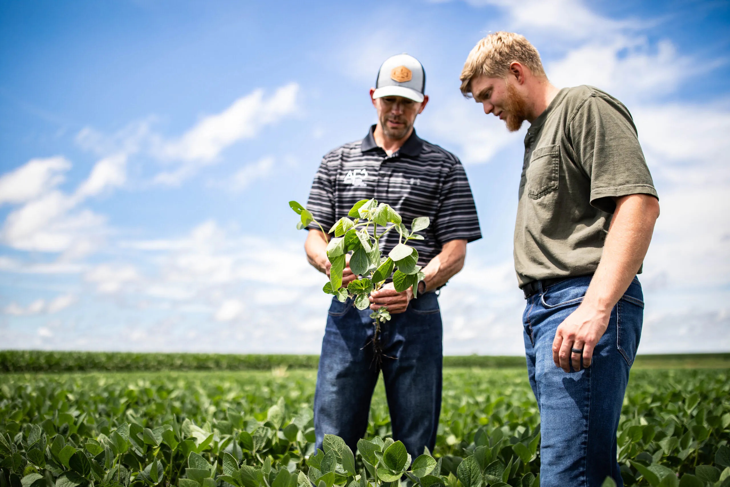
CHS Agronomy offers a concrete example of the distribution model: growers use Taranis with their CHS advisor to prioritize fields, evaluate results and revise plans. The retailer already has the relationship. Taranis supplies another reason for that relationship to be useful. A photograph makes a recommendation easier to discuss than a solemn announcement that a field “looks stressed.”
The seasonal packaging is equally revealing. Advanced+, Elite+ and Pro+ list four, five and six missions respectively, with different capabilities and support. Co-branding and white-label options let retailers make the service part of their own offering. Commercially, Taranis combines subscription software with collection and support. Buying it means buying an ongoing workflow, including the awkward business of getting the aircraft to the right field.
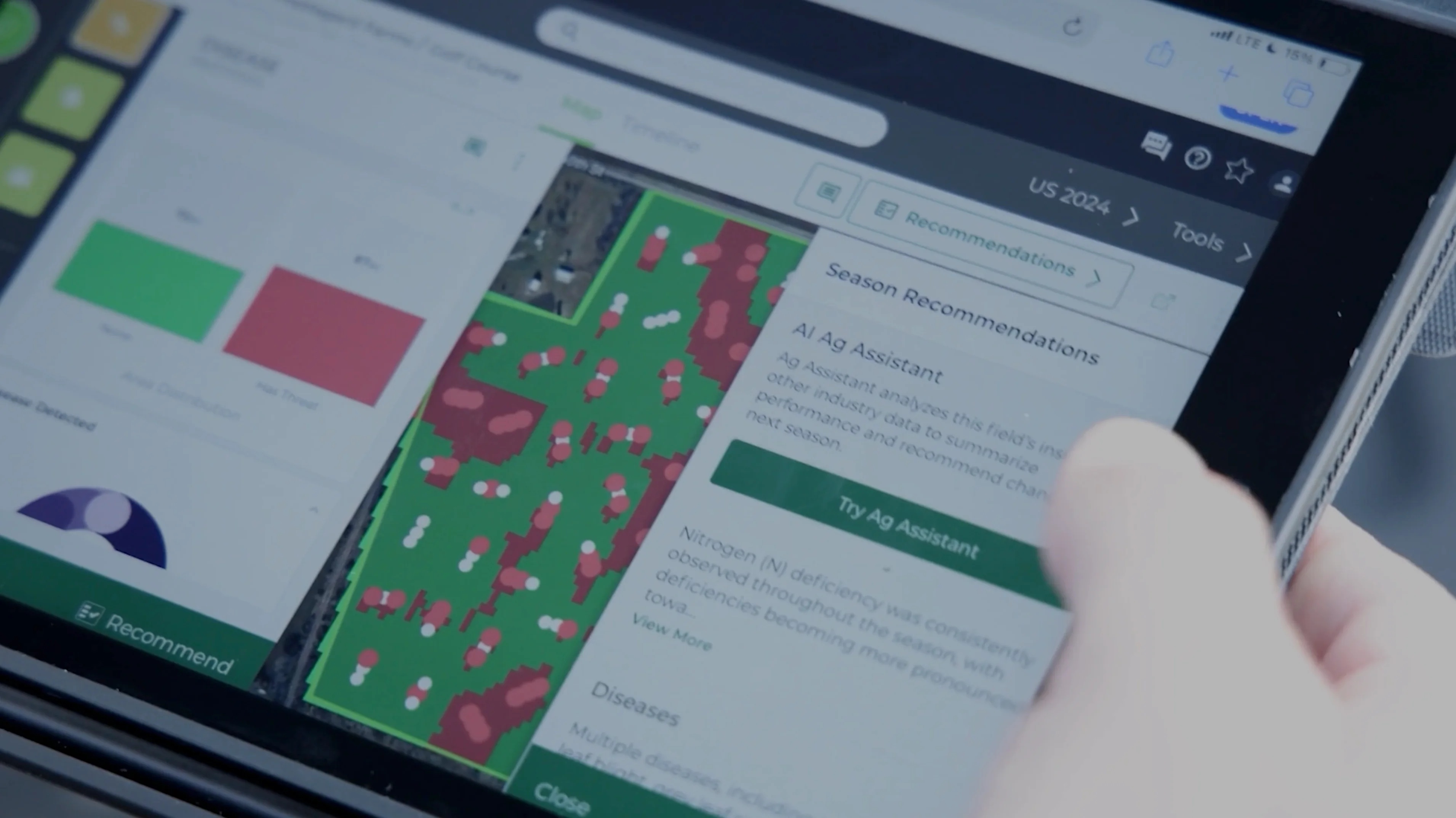
Ag Assistant, launched in July 2024, adds another layer. It combines crop observations with sources such as weather, machinery data, university research and product studies to generate field-specific reports and recommendations. The point is to reduce the time an agronomist spends assembling context. The advisor still has a crop, a customer and a decision to consider.
In October 2025, Syngenta formalized an expanded strategic partnership with Taranis. The companies said participating retailers had reported earlier responses to field issues and less manual scouting during their collaboration. That reported experience supported expansion across Midwest retail partners in 2026. It is a reason to broaden a program; it is not a controlled estimate of every grower’s return.
“This partnership allows us to scale that proven model across the Midwest.”Vern Hawkins, Syngenta · October 2025
The expensive question behind a cheap-looking weed
May 2026 brought Yield Impact, which integrates the DSSAT crop growth model with Taranis’s leaf-level observations. It estimates yield losses associated with weeds, disease, insects and nutrient deficiencies in bushels per acre. For the 2026 season, it is available only on enrolled corn acres. Soybeans are announced for 2027. An estimate of loss gives a grower a more useful starting point for deciding whether treatment can pay.
The arithmetic deserves restraint. Multiply plausible recoverable bushels by crop price, then compare that value with the full intervention cost. Estimated threatened yield is not automatically recoverable yield. Treatment efficacy, timing and application expense matter. A striking photograph may justify investigation; it does not, by itself, justify the bill.
Recoverable yield × crop price
compared with
Treatment + application cost
A photograph with a second job
Taranis Conservation, launched in December 2024, extends the business into conservation planning, enrollment and practice documentation. Its fees apply when funding is secured. Here the field record can support another task: demonstrating what a grower has done. The service fits the same pattern as scouting: combine evidence with assistance on a process that consumes scarce attention.
Look closely, then do the arithmetic
The alternatives include walking fields, satellite monitoring and other aerial analytics services. Taranis’s distinctive proposition combines leaf-level evidence with organized acquisition and retailer-led advice. Its limits follow the same chain: imagery must be usable and timely, recommendations must fit the crop, and someone must act. The 2026 SiFly field validation program, testing longer-endurance drone collection, acknowledges that acquisition efficiency remains work to do.
The lesson travels beyond farming. Put better evidence inside a relationship that already works. Check its quality. Attach it to a decision and a cost. Taranis has made the ladybug a memorable demonstration. The farmer’s more enduring interest is whether looking closely changes what happens next.