A city has the bad manners to change after you have mapped it. A building gains a floor. A shed becomes a workshop. An insurer’s handsome atlas becomes, quietly, wrong. Sanborn’s early answer was wonderfully physical: paper corrections, called pasters, attached to the existing map. The customer could update a volume without replacing the whole thing. Long before software acquired an update button, the atlas had glue.
- Sanborn sells geographic data, analysis and software to governments and businesses.
- Its work connects aerial surveys and lidar with the tools people use to inspect property, plan infrastructure and manage resources.
- The useful lesson: buy the information your decision requires, and plan how to keep it current.
The atlas had an update problem
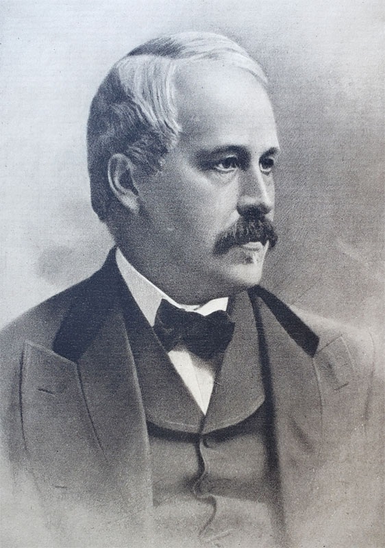
Daniel Alfred Sanborn’s original market was fire insurance. Underwriters needed building-level information about materials, uses and surroundings. A street name alone would hardly settle the matter. The company dates its work to 1866; the Library of Congress account places establishment of the original firm name in 1867. Today those insurance maps are historical records, useful precisely because they recorded details a less fussy mapmaker might have left out.
Then the customer changed. Sanborn’s company history describes declining demand for insurance cartography as that industry modernized. It expanded into planning, utilities and other mapping, then adopted aerial photography and digital geographic information systems. The pressure arrived in the original market before the mapmaker exhausted its uses. Paper was a delivery method; knowledge of buildings and terrain could serve other buyers.
That distinction explains the modern business better than nostalgia does. A utility, an engineer and a municipal assessor may all look at the same landscape. They need different answers from it. Sanborn’s job is to collect the relevant observations, turn them into usable geographic data, and help those observations survive contact with an organization’s actual work.
First the aircraft. Then the argument.
Some of that work begins above the ground. Sanborn collects aerial imagery and lidar, makes orthophotos and develops three-dimensional models. Orthophotography gives a geographically corrected view from above. Oblique imagery supplies angled views, useful when the side of a structure matters as much as the roof. Lidar measures distances with laser pulses to help describe the shape of the landscape.

In November 2025, Sanborn introduced one-inch ground sample distance oblique imagery. Each pixel represents an inch on the ground. Compared with three-inch sampling, that is nine samples across the same ground area, a geometric comparison rather than a promise of nine times the business value. Resolution also needs to be distinguished from positional accuracy: finer pixels alone do not tell you how accurately a feature has been located.
Illustrative geometry. More samples are useful when the task needs the detail.
The expertise continues after collection. Photogrammetry extracts measurements from images; processing turns observations into surfaces, features and models. In July 2024, Sanborn acquired VeriDaaS assets to add photon-counting lidar capabilities to its Mapping Division. The announcement described an asset purchase, a distinction worth preserving. Owning useful technology and buying an entire company are different transactions.
The map gets a job
Sanborn’s 2022 acquisition of Applied Geographics, or AppGeo, added consulting and application development. That moves the company further into the awkward interval between receiving data and using it. A survey delivered to a department is one achievement. Getting the department’s systems, staff and routines to make use of it is another.
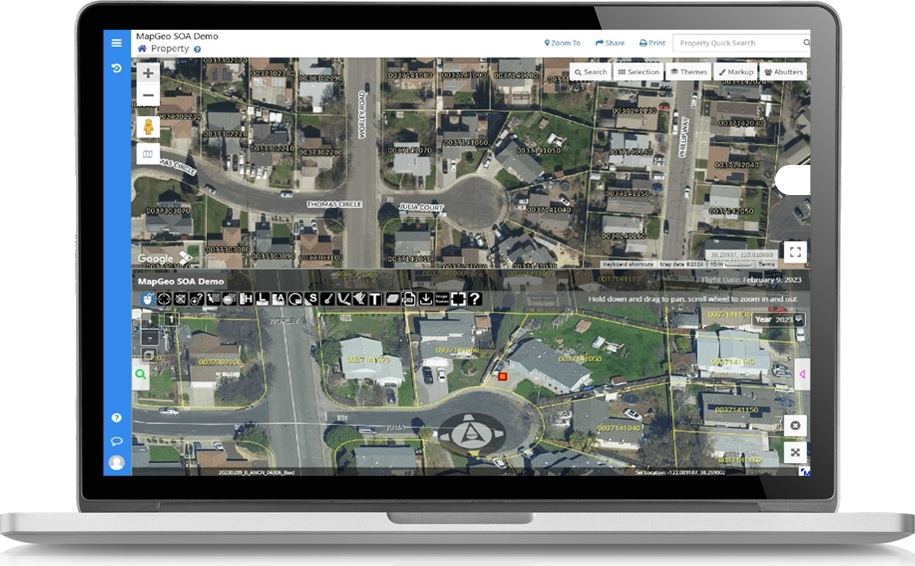
The product family reflects that interval. Oblique Analyst lets people inspect angled imagery and measure height, length and area. MapGeo presents municipal geographic information in a web interface. GeoServe supports distribution and quality review of mapping data; Giza streams imagery. Custom applications and GIS consulting cover work that a ready-made viewer cannot settle.
Consider Missouri. Its Office of Broadband Development launched an interactive availability map using Broadband Navigator in February 2024. The announced purpose was to help inform investment of $1.7 billion in BEAD funding and support the state challenge process. That number describes a public funding program, not Sanborn’s contract or revenue. The application also supported providers delineating proposed project areas. Here a map becomes part of a procedure for deciding where infrastructure should go.
Or consider a driver. Sanborn announced delivery of TxDOT’s official DriveTexas mobile app in August 2026. The free iOS and Android application puts official road conditions, construction and emergency-route information into a mobile mapping interface. TxDOT separately reported that the website reached nearly 79,000 users at its July 16 flood-period peak, compared with a typical daily average of 2,200. Those are website figures, not app adoption. They make the practical demand for travel information rather vivid.
- 01CollectImagery, lidar, sensors
- 02InterpretFeatures, models, layers
- 03Put to workApps, decisions, support
The customer list therefore includes transportation departments and municipalities, utilities, engineers and resource managers. A 2026 MAPPS award recognized Sanborn’s tree-canopy work with the Maryland-National Capital Park and Planning Commission and Prince George’s County. The analysis identified canopy gaps and planting priorities. The interesting output is a place to act, rather than another green layer to admire.
The expense before the first pixel
This is a mixed business: contracted surveys and analysis, software, commercial data licensing, consulting and continuing support. The bill depends on the assignment. A public regional buy-up presentation dated February 21, 2016 makes the components unusually visible. It listed $10,000 for mobilization, divisible among participants, and $14,000 for the optional Oblique Analyst application, with optional maintenance of $2,900 a year starting in year two. These are historical proposal prices, not today’s quotations.
Aircraft mobilization, shared among participants.
There is a sensible idea hiding in that line item. Geography does not respect municipal budgets. Neighboring buyers can discuss a common collection area before separately paying to get an aircraft into position. In its August 2026 Nevada geothermal survey announcement, Sanborn said a helicopter already working nearby helped reduce the client’s mobilization costs. Logistics remains part of the product, even when the finished deliverable arrives through the cloud.
That gives Sanborn a position between data collector, software supplier and GIS adviser. Buyers also have specialist vendors and other survey firms available; Michigan’s aerial-imagery procurement directory lists both Sanborn and Woolpert. Sanborn’s case for combining services is fewer handoffs from acquisition to application. The advantage depends on whether those services fit the particular project. Breadth alone cannot make that decision.
A city model still needs a city to use it
Sanborn’s Digital Twin Base Map is a good test of the distinction. Its 2023 announcement described a customer delivery covering more than 400 square miles. A geographic base can support simulation when combined with other data, but a three-dimensional city does not automatically become a working forecast of traffic, water or energy. Someone must define the question and supply the relevant information.
“useful, usable, and used widely”
Michele Giorgianni · AppGeo Division
Sanborn’s stated standard for the systems it builds
For a buyer, the copyable habit is to work backward. Identify the decision, specify the data and accuracy it needs, then decide who will maintain the result. Plan integration and staff time alongside collection. Sanborn’s program-support offering includes precisely those less photogenic activities: strategic planning, consulting and staff augmentation.
This approach has limits. An occasional overview may be adequately served by existing imagery. A detailed survey may be excessive for that job. Conversely, a photograph cannot reveal every underground condition, and a captured scene ages as the place changes. A custom application will also disappoint if the organization cannot maintain its data. The old paster carries the lesson neatly: useful information needs an update plan. Glue was merely the first implementation.
Take a closer look
Explore Sanborn, its news, resources and webinars, and the Oblique Analyst demos.