The emergency map of a school is usually at its most impressive on an ordinary Tuesday. The doors are numbered. The hallways behave. Nobody is trying to explain over a radio whether “the library” and “the media center” are the same room. Then something happens, several agencies arrive, and a perfectly serviceable floor plan becomes a translation exercise performed at speed.
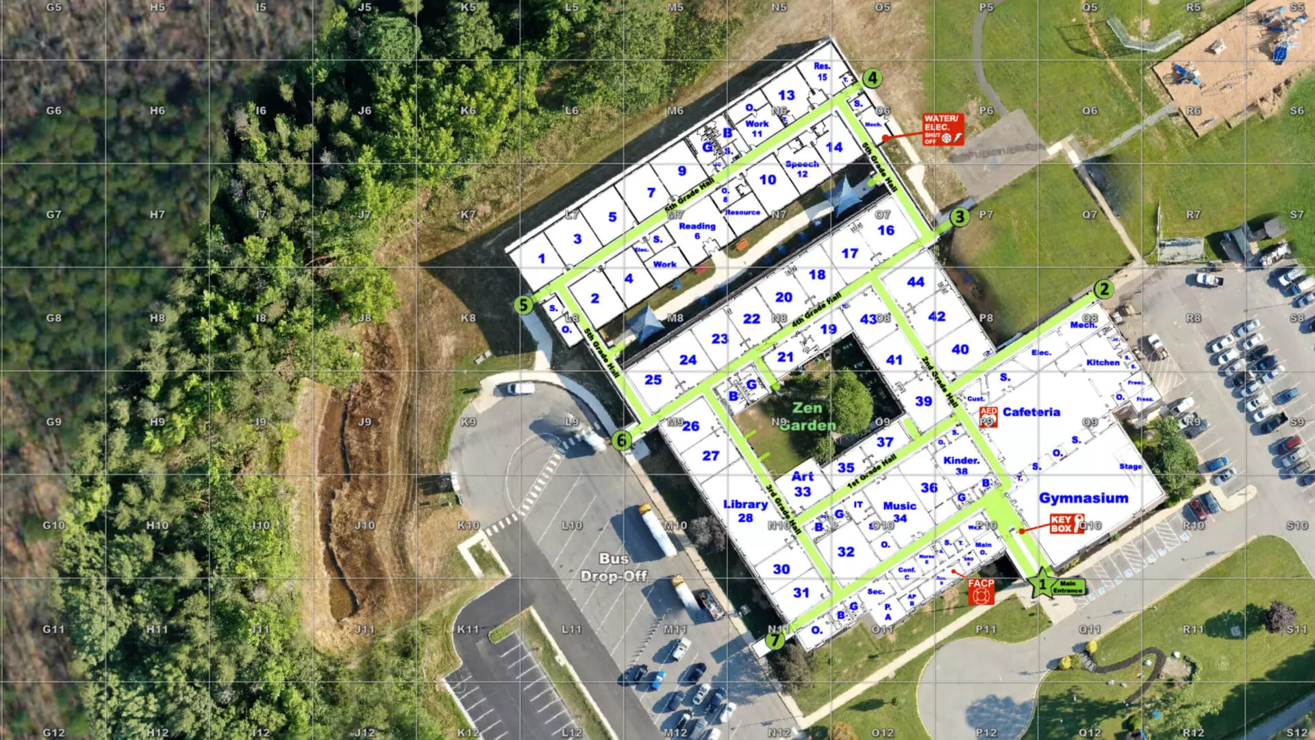
Critical Response Group built its business around that ugly handoff. The Hamilton, New Jersey, company turns architectural plans, aerial imagery and a physical walk-through into a common operating picture: one north-up, gridded, clearly labeled map of the inside and outside of a place. School administrators, dispatchers, police, fire and emergency medical teams can all point to the same door, stairwell, utility shutoff or staging area. The ambition is modest enough to sound obvious. The execution is why CRG has grown.
01 / The first failureA map is a language with walls
Hardy Allen, a CRG regional director, offered the blunt version while discussing New Hampshire's new statewide program: “The first thing to break down is always communications.” That is especially true when mutual-aid teams converge on a building they have never entered. One officer knows the room as 117. A teacher calls it the library. An old drawing calls it the instructional-media suite. All three can be correct and still waste time.
A Collaborative Response Graphic, or CRG, forces those tiny disagreements into the open before the bad day. Micro CRGs cover individual floors. Macro CRGs cover the campus, parking, roads and nearby properties. Both use a grid, site-specific labels, current imagery and fixed orientation. Critical features can include doors, stairwells, fire connections, trauma kits, defibrillators and utility controls. Paper copies remain part of the plan, a refreshingly practical admission that batteries and networks have personalities.
02 / The originFrom raid board to school hallway
CRG formed in 2016 from the geospatial intelligence division of The Rodgers Group, a public-safety consultancy. Co-founder and technology chief Ethan Killeen brought eight combat deployments as an Army Ranger. Co-founder Keith Germain brought the domestic view of a police chief and emergency manager. The team grew into a mixture of former Special Operations personnel, public-safety officials, engineers and mapping specialists.
Mike Rodgers, another West Point graduate and former 75th Ranger Regiment officer, became chief executive in 2020. The turning point he describes is wonderfully mundane: after using gridded maps overseas, he discovered that the school where his wife taught had nothing comparable. He mapped it. The mismatch changed the question from “Would military-style visual coordination work here?” to “Why would responders enter a complicated civilian building without it?”
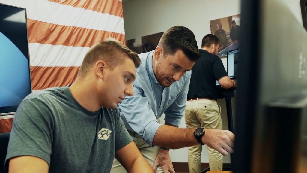
That backstory matters, but only up to a point. A school is not a battlefield, and importing military culture wholesale would be both crude and counterproductive. CRG borrowed a narrower habit: simplify spatial information for stressed teams that do not routinely work together. Its relevance stretches beyond armed threats to fires, medical calls, evacuations, reunification and natural disasters.
03 / What they actually sellThe fieldwork is the feature
The visible artifact is the map. The service wrapped around it is the business. A customer supplies existing plans and identifies the agencies that need the data. CRG coordinates with dispatch and responders, visits the property, reconciles the drawing with reality, builds the geospatial layers, distributes them into operational systems and trains users. Security consulting, policy development and HSEEP-compliant tabletop or full-scale exercises extend the engagement.
This makes CRG a peculiar hybrid: professional services, geospatial data, public-safety infrastructure and software. The CRG Portal gives current customers a secure place to access, edit, download and distribute their maps; responder access is complimentary. Its 2026 Map Builder lets facilities teams reuse the verified base map for everyday jobs such as parking plans, events and reunification. In June, CRG bought GXP OnScene from BAE Systems after five years as the app's exclusive sales, implementation and support partner. Renamed CRG OnScene, it puts the company in direct control of a mobile field interface used by tens of thousands of responders and security professionals.
04 / The billSeveral thousand dollars, plus the boring forever
CRG does not publish a universal menu price, and public programs are not apples-to-apples. Still, contracts reveal the order of magnitude. Virginia offered reimbursement of up to $3,500 per mapped school. Sarasota County authorized as much as $300,000 for CRG services. New Hampshire approved a $2.6 million statewide contract in 2026. The Associated Press found that a single digital school map can cost several thousand dollars, with integrations raising the total.
Public money makes the market visible
Bars show contract scale, not comparable unit prices. Building count, size, imagery, integrations, training and maintenance differ.
The most important cost arrives later. Buildings change. A classroom becomes an office; construction eats an exit; a new wing appears. CRG has said it re-walks structures annually and accepts interim changes from customers. Without that ownership, a polished map becomes a confident liar. Washington state learned the maintenance lesson with an earlier mapping system: updates dwindled, funding proved insufficient and the program ended in 2021. Its former manager put the risk neatly - wrong information can be worse than none.
05 / Moat and marketSoftware-agnostic, policy-adjacent
CRG's competitive position rests on three claims. First, people walk the site. Second, the graphics follow a consistent visual grammar tested with responders. Third, the data can appear inside platforms customers already own. Its integration list reads like a public-safety trade show: Esri, Axon, Everbridge, Intrado, RapidDeploy, Raptor, SaferWatch, Hexagon, CrisisGo, ReadyOp and many more.
That system-agnostic pitch matters because a map stranded in a vendor portal is a brochure with a password. CRG says its graphics can reach a 911 screen, a patrol laptop, a phone, a real-time crime center or a printed command board. By mid-2025, the company said it had mapped more than 20,000 American schools. A July 2026 report put its wider footprint - schools, colleges and critical-infrastructure sites - above 40,000. The company record supplied for this profile places headcount around 180, consistent with a 175-person estimate reported in 2024.
Competitors include GeoComm, CENTEGIX, Navigate360, nSide and 3AM Innovations, along with a county's own GIS team or its aging folder of PDFs. Some rivals bundle maps with panic buttons or broader safety software. CRG's bet is that the map should be the neutral layer beneath those systems.
There is a political edge. More than 20 states have enacted or proposed digital school-mapping measures, creating a market shaped by grants and statutory specifications. An AP review found CRG had hired lobbyists in more than 20 states to advocate for standards including site verification, true-north orientation and free compatibility with existing software. Rival vendors lobbied too. Those provisions can improve a map; they can also resemble the incumbent's product sheet. In New Jersey, a state police official told the AP that CRG was the only available product meeting the legislative criteria when the state went shopping. Buyers should hold both ideas at once: operational standards are useful, and standards influenced by sellers require scrutiny.
06 / The useful copySteal the discipline, not the camouflage
The transferable lesson is not to hire veterans or draw grids over everything. It is to begin with the user on their worst day. CRG removed choices that are harmless in calm conditions and costly under pressure: which way is north, what a room is called, where one floor meets another, whether the dispatcher and officer have the same version.
This approach works best where the facility is complicated, responder turnover is real, multiple agencies may arrive and local leaders will maintain the data. It is weaker where a site changes constantly, nobody owns updates, dispatch cannot retrieve the map, responders never train with it or sensitive drawings are casually shared. A rural district with poor connectivity needs offline access and paper. A tiny, simple facility may get more value from better door numbering and a joint walk-through than from an elaborate software project.
When the map becomes theater
Stale plan + no integration + no rehearsal = an expensive artifact. Grant money can buy the first version; it cannot supply local ownership forever.
07 / The next layerOwning the screen changes the company
McCarthy Capital's reported $49 million growth investment in 2024 gave CRG room to expand products and distribution. The OnScene acquisition shows where it is headed. CRG began by making the underlying picture and partnering with the software around it. Now it owns a widely deployed responder app, while Map Builder invites facilities staff to use verified data on non-emergency days. Partnerships announced through 2026 connect CRGs with PulsePoint, LeoSight and the OPS Network, mixing static building intelligence with live cameras, drones, license-plate readers and incident locations.
That creates opportunity and a clean strategic hazard. The company became valuable by acting as the map that could live everywhere. As it builds more of its own interface, it must avoid turning openness into a slogan. Customers will want data portability, security, durable access and proof that annual verification survives fast growth.
CRG's smartest idea remains almost embarrassingly analog: before the crisis, walk the building with the people who will answer the call. Look at the doors. Agree on the names. Put the same picture where everyone can reach it. The software makes that agreement travel. The agreement is what makes the software matter.