Seven hundred thousand vending machines make a curious kind of map. Each machine is a tiny shop, with its own customers, passing crowds and disappointments. Coca-Cola Bottlers Japan needed to understand that geography. A machine’s sales figures could say what sold. Location data could help explain why it sold there - and whether another corner offered a better opportunity.
- CARTO brings maps and spatial analysis to data already held in cloud warehouses.
- Customers use it for network planning, site selection, risk assessment and market analysis.
- Its AI agents give business users access to analytical tools designed by specialists.
The bottler’s older approach involved extracting information, building an analytics warehouse through ETL tools, and maintaining the machinery around it. Simple queries took too long. The company built an analytics and machine-learning platform centered on Google BigQuery, with CARTO visualizing the results. Points of interest and foot traffic added context to the sales ledger. The problem had become less about drawing machines and more about understanding their neighborhoods.
That distinction explains CARTO. A dot on a map is easy to admire. Deciding where to invest, which customers to reach, or how to arrange a network requires a connection between geography and the business’s own records. CARTO sells the software that makes that connection usable.
The two letters that had to go
Javier de la Torre and Sergio Álvarez founded the company in Madrid in 2012, drawing on conservation and environmental projects. Those projects had exposed the difficulty of analyzing large amounts of location data. The same difficulty appeared elsewhere: insurers, banks and telecommunications companies also had questions whose answers depended on place.
The early name, CartoDB, wore its database credentials openly. By 2016, the company said its users had shifted from specialist developers toward business people with little programming knowledge. It introduced Builder and dropped “DB.” The name was catching up with the customer. A database acronym is an odd invitation to someone trying to choose a shop location.
The next consequential shift concerned infrastructure. In 2021, CARTO launched a new cloud-native platform. Customers were moving their data into cloud warehouses; CARTO followed the data. That December, it announced a $61 million Series C led by Insight Partners, alongside the European Innovation Council Fund and existing investors. The wager was that spatial analysis should join the modern analytics stack.
Leave the data. Move the question.
Consider a retailer comparing possible stores. It needs sales records, competitors, demographics and some definition of a catchment area. CARTO’s Data Observatory offers roughly 12,000 public and premium data products to help supply that surrounding context. Useful geography often begins outside your own spreadsheet.
Builder supplies the interactive map. Workflows supplies a visual way to assemble analytical steps, compiling the pipeline into SQL for the connected warehouse. The Analytics Toolbox adds spatial functions and procedures. Developers can use APIs and deck.gl to build custom applications. This is an arrangement of tools around the same underlying data, rather than a requirement that everyone learn the same interface.
CARTO supports platforms including BigQuery, Snowflake, Databricks, Redshift, Oracle and PostgreSQL. Its warehouse approach reduces the need to maintain a separate analytical copy. Dynamic Tiling generates map tiles on demand from warehouse queries, connecting the visible map to that architecture. The technical distinction matters when the records are numerous, sensitive or frequently changing.
Its competitive position sits between enterprise GIS, warehouse analytics and application development. ArcGIS offers a broad GIS environment. QGIS and PostGIS give teams open-source alternatives. Native warehouse SQL can answer spatial questions directly. CARTO packages analysis, visualization, enrichment and sharing for organizations that want those capabilities close to their existing cloud data.
The hundredth request should be a tool
A GIS specialist might design a sound analysis once, then spend the week rerunning it with different addresses. CARTO’s AI proposition addresses that repetition. Experts configure tools, instructions and access; colleagues can ask questions in ordinary language. The specialist’s judgment lives in something reusable.
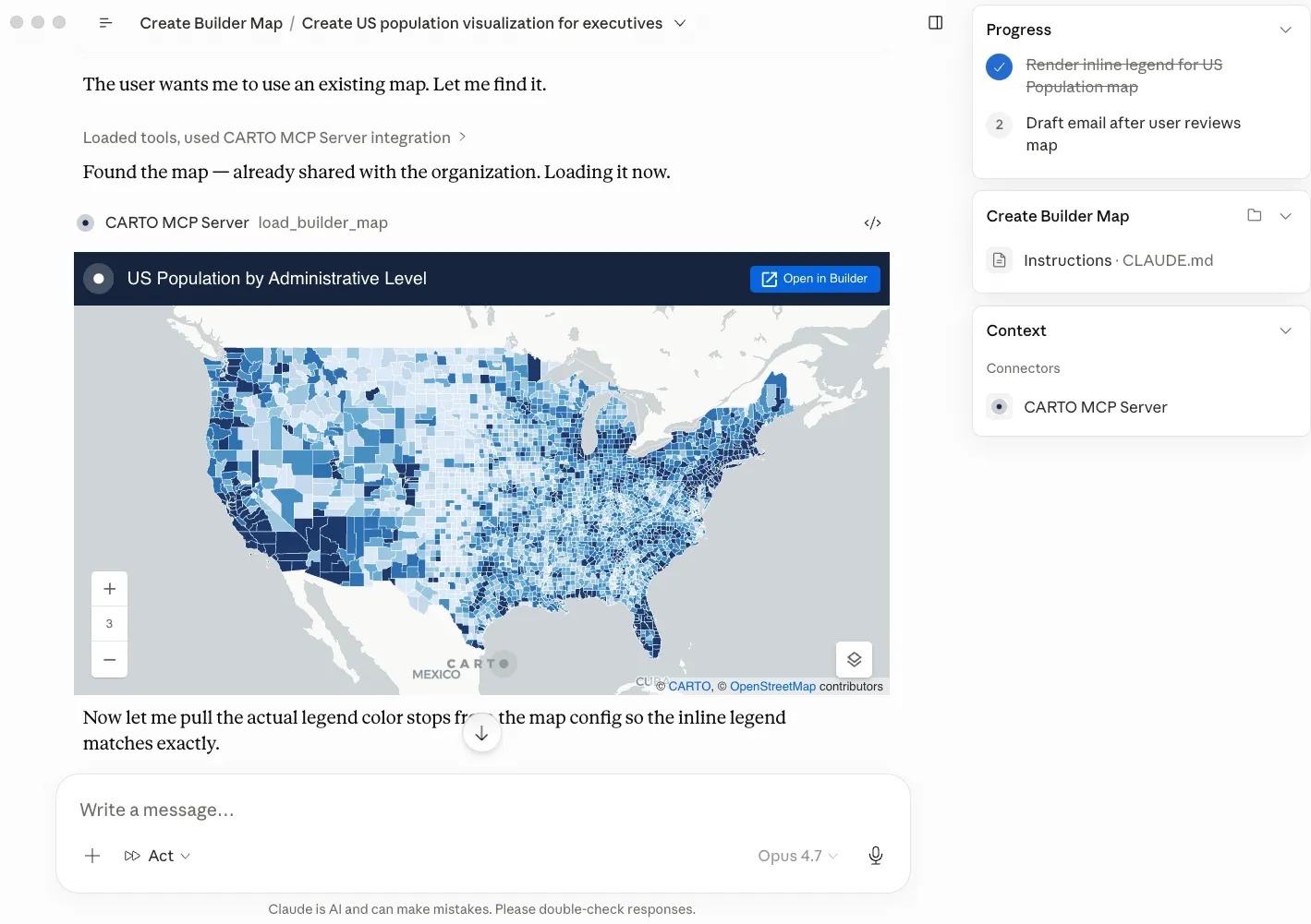
There are two directions of travel. CARTO AI Agents operate inside maps and applications. CARTO for Agents, introduced in May 2026, lets outside platforms such as Claude and ChatGPT operate CARTO through its MCP Server, command-line interface and Agent Skills. The map can contain a conversation; a conversation can also call the mapping platform.
The less theatrical development is traceability. CARTO’s July 2026 product update described visibility into tools executed, parameters, outputs and generated SQL. That gives analysts something to inspect when an answer looks suspicious. A fluent explanation does not establish that the calculation was sensible.
“put the data that we were working with, in the hands of the subject matter experts”
Tim Kiely, Hodges Ward Elliott
The company’s customers extend across real estate, telecoms and finance. Its historical Hodges Ward Elliott account described map production falling from four hours to about ten minutes. More telling was the ability to share interactive results with people who understood the properties. Treat that as one customer’s experience, not a universal speed guarantee.

The bill follows the work
CARTO is enterprise SaaS, with self-hosted options and professional services. In June 2026 it explained a move toward consumption pricing, arguing that seats were a poor measure when automated workflows and agents perform the work. Its plans include metered usage and annual commitments. The flexible plan’s pricing page also specifies monthly billing with a 12-month contract. Flexibility deserves a careful reading.
A buyer should budget for the platform, warehouse compute, licensed data and implementation. More questions can mean more usage. The approach fits an organization with usable location records, supported infrastructure and recurring decisions. For a small, occasional mapping task, lighter tools may suffice. Poor coordinates, stale demographics or badly scoped permissions will still spoil an analysis.
The practical lesson is modest enough to copy: take one recurring request, make its assumptions explicit, build a reusable workflow, and measure turnaround time and cost. CARTO’s proposition becomes convincing when the person who knows the business can reach the analysis without waiting for another map to arrive.