A road can be perfectly visible and still be years away from changing. The curb is there. The bus stop is there. The people trying to get across the street are certainly there. What has yet to arrive is the study: the assembled evidence, the alternatives, the explanation of what should happen next. Varun Tandon has built a company around this interval between an obvious place and a usable plan.
Tandon is the co-founder and CEO of Waypoint Transit, which automates urban planning work for municipalities. He previously worked on applied machine learning at Microsoft, including diffusion models and large language and multimodal models for Copilot, Designer, and PowerPoint. His present working vocabulary includes corridor studies, municipal codes, and geographic information systems. The scenery has changed considerably; the technical tools have travelled with him.
There is a certain comic modesty to the destination. Someone who has worked on software for generating images and assisting office work is now helping governments prepare reports. Reports rarely get applause. They do, however, help determine what can be built. Waypoint places Tandon in the quieter stretch of infrastructure, where an analysis must become legible before a proposal can become actionable.
His career gives that choice an interesting shape. The public record includes student experiments with difficult text, a travel-planning project, work on widely used Microsoft products, and a startup serving city staff. Across those projects, the practical question keeps returning: what would make a complicated body of information easier for someone else to use?
An itinerary, an agreement, an engineering education
Tandon earned both a bachelor’s and a master’s degree in computer science at Stanford. He met his future co-founder, Ryan Johnston, there. Johnston studied electrical engineering. Their eventual partnership joins two different engineering backgrounds, but Tandon’s student projects also show interests that extended beyond a single technical specialty.
One Stanford natural-language-processing project paired him with Hannah Zhang and German Enik to work on terms-of-service agreements. The team developed a pipeline that selected material from legal documents and attempted to simplify it. Their stated aim was transparency for people using online services. It was a student project about a familiar little ceremony: clicking acceptance beneath words that few people have patiently read.
The report matters here because it puts Tandon close to a problem of explanation well before Waypoint. Legal prose can be available to everyone and comprehensible to relatively few. The project treated that gap as something software might help narrow. It did not need to invent information; it needed to make existing information more manageable.
In 2022, Stanford computer science student Connor Hogan described building Rockhopper with Tandon. The travel website could generate an itinerary around a location, including activities and meals, with travel time considered. It also allowed people to explore itineraries shared by others, copy them, and adjust them. The scale was a day trip or a date night rather than a transportation corridor.
It would be too tidy to call every student experiment a rehearsal for a later company. Rockhopper was its own project. Yet it supplies a pleasing detail in this story: before Tandon worked on planning for cities, he worked on planning a way through them. A restaurant recommendation and a corridor study have very different consequences, but both require decisions about places and connections.
Two routes out of Stanford
Microsoft gave Tandon experience applying machine learning to products people actually use. His work involved Copilot, Designer, and PowerPoint, according to his founder biography. Those names help explain the kind of background he brought to Waypoint: models working inside software with a purpose, rather than research presented in isolation.
Johnston followed another route. He worked on chip-design synthesis software at Apple, then developed real-time transit signage for his hometown. That signage project eventually became Waypoint. The company’s website still lists the Duluth bus-signage work as a completed legacy project, a small reminder that the business has an earlier life attached to a particular place.
Waypoint was founded in 2024 and joined Y Combinator’s Winter 2025 batch. Its founders framed infrastructure planning as a field full of repeated work: gathering information, combining datasets, producing maps, and writing reports. Their proposal was to automate more of that preparation so public agencies could move projects along with less expense.
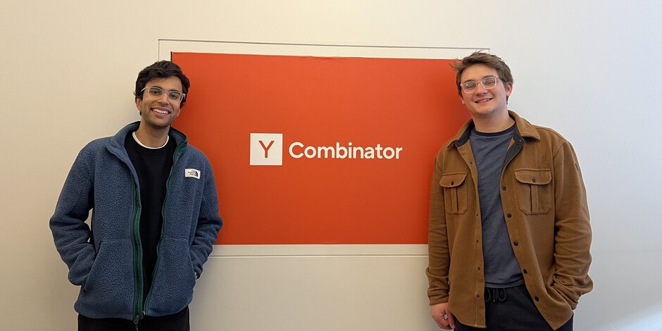
For Tandon, the partnership connected his AI experience with Johnston’s transit work. The photograph of them standing beside Y Combinator’s orange sign is an uncomplicated record of that new chapter: two engineers, two jackets, one company. No hard hat is required to begin changing the work that precedes construction.
What the software has to do on Monday morning
Today Waypoint presents an assistant that connects to the information planners use. Its website describes geospatial analysis through ordinary language, permit review against municipal codes, and integration of datasets such as transit feeds and geographic layers. These are specific jobs with specific outputs. A useful memo must fit the agency’s format; an analysis must answer the agency’s question.
This makes the interface interesting. A planner can ask for a spatial operation in words rather than remember a particular sequence of GIS controls. The promised convenience is close to the ordinary office task of finding the right command, except that the information describes roads, development, and movement through a town.
The company also lists work in Santa Fe, Teton County, Marin County, Berkshire County, Walnut Creek, and Duluth. The projects range across inventories, transportation analyses, accessibility, corridor planning, and signage. That variety helps explain why Tandon’s company offers customized workflows alongside a general assistant. Municipal work arrives with local requirements, existing documents, and a preferred way of presenting an answer.
- 01 / GatherPlans, maps, municipal records
- 02 / AnalyzeConnect information to the question
- 03 / ReviewLocal expertise and policy judgment
A curb is a surprisingly technical object
Computer vision gives Waypoint another route into the problem. In a Roboflow case study, the company describes extracting infrastructure features from satellite imagery, including roads, sidewalks, and curbs. An intersection can become a collection of features that software identifies and organizes, rather than a picture someone must inspect entirely by hand.
One example involves daylighting intersections. Waypoint’s models identify curbs and classify uses such as parking areas, red zones, and driveways. The system then supports analysis of the costs and benefits of changes, helping teams decide where to concentrate their efforts. The case study describes training with datasets as small as 400 images and processing imagery in the cloud.
A curb sounds like an object of almost heroic simplicity until someone has to inventory thousands of them. Then its location, use, and relationship to an intersection become a data problem. This is the sort of unglamorous specificity that makes the work worth examining. The model has to recognize something useful in a real place before its output can help a planner.
Training images in a small dataset described in Waypoint’s computer vision case study.
Lincoln Avenue supplies the difficult questions
In San Rafael, Waypoint worked with the Transportation Authority of Marin on a Lincoln Avenue corridor-study pilot. Agency staff had been exploring less expensive approaches to planning. Waypoint approached TAM in 2025; the resulting project involved TAM, San Rafael, and Marin Transit, with agency staff managing scope and collecting information.
The April 2026 account describes an exploratory study evaluating tools and process. Its findings were not adopted city or TAM recommendations. Local expertise and policy decisions remained necessary. Staff saw opportunities to streamline information gathering, existing-conditions analysis, and the development of possible treatments.
The draft went to San Rafael committees, and an executive committee asked how the work would inform future projects. Members also wanted before-and-after simulation to help communicate alternatives to the public. These are useful questions for Tandon’s business. Speed matters, but so does the next person’s ability to inspect an answer, understand its implications, and decide whether it belongs on their street.
The people on the other side of the screen
Tandon’s public introduction to Waypoint emphasized what he and Johnston had learned in conversations with city-government workers. His emphasis places the people buying and using the software inside the company’s learning process, where they have information an engineering team needs.
A later hiring post sought engineers with “meticulous attention to detail” and described close work with municipalities across the country. The roles included a founding engineer and an internship in San Francisco. As a statement of what Tandon wanted in colleagues, the wording fits the work: an urban-planning tool has to earn its usefulness through the particulars.
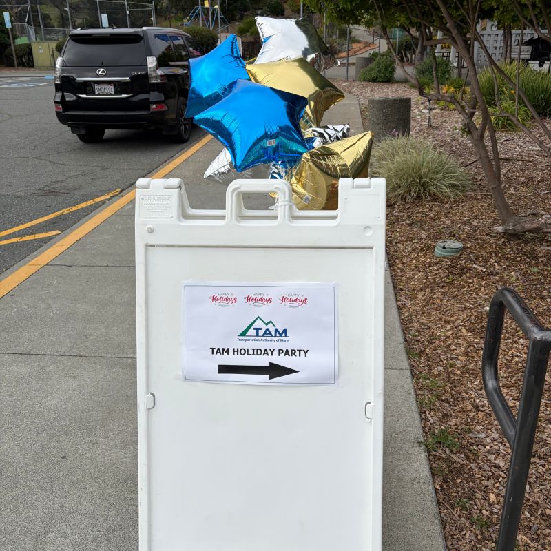
There is a less technical glimpse in his holiday-party post about the Transportation Authority of Marin. Tandon thanked Derek McGill and Mikaela Hiatt for their invitation and partnership. The accompanying photograph shows a party sign and metallic star balloons outside. Even a business devoted to automation has occasions requiring people to show up, follow an arrow, and meet one another.
The professional conversation continued into 2026. An April planning-symposium agenda named Tandon and Johnston alongside Erick Aune of the Santa Fe MPO for a session on planners automating tasks with AI agents. The listing puts the founders in a room organized around the working concerns of regional planners. Their technology has to make sense there, among people with their own responsibilities and experience.
Tandon’s stated ambition with Waypoint is to help cities build infrastructure faster and at lower cost. His route to that ambition has passed through classrooms, consumer software, an itinerary website, and now municipal workflows. The outcome remains a practical one: give the people responsible for a place more capacity to work on it. Before the street can change, the work has to move.
“We’ve learned so much talking to folks working in city government.”
Varun Tandon, introducing Waypoint