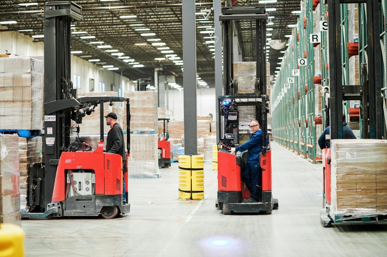
A picker steps out from behind a warehouse rack. A forklift turns the corner. Neither person can see the other. It is an ordinary arrangement of shelves, bodies and moving steel, which is precisely the problem: danger does not always announce itself with an extraordinary event. Sometimes it arrives as a perfectly normal Tuesday.
- Redpoint puts location awareness on workers, vehicles and assets.
- Compatible vehicle integrations can turn proximity data into automatic slowing or stopping.
- Customers can begin with warning tags, then add reporting and facility-wide positioning.
Redpoint Positioning builds ultra-wideband real-time location systems, or RTLS. Its proposition begins with finding things indoors. Its more interesting ambition is to make that knowledge useful before a person has time to react. A dot on a screen is reassuring. A truck responding to that dot is consequential.
Six hours waiting to be found
The company’s origin story starts somewhere conspicuously unlike a warehouse. According to Redpoint, co-founder Chunjie Duan suffered a serious snowboarding accident in Japan and spent six hours alone awaiting rescue. During the wait, he considered how his research in location technology might help in real situations. The problem had acquired a rather persuasive demonstration.
Duan and Georgiy Pekhteryev had met at Mitsubishi Electric Research Labs. Redpoint’s current history dates their company to 2014. Duan brought experience in wireless communications and signal processing; Pekhteryev brought wireless product development and digital networks. Their backgrounds help explain the company’s emphasis on both locating a device and communicating with it.


The useful map is inside the truck
Wearable tags identify workers. Vehicle tags identify trucks and robots. Fixed anchors establish coverage around a site. Redpoint advertises location accuracy up to 10 centimeters, but precision is only one part of the task. Knowing exactly where someone was a moment ago is less useful when the machine is still moving.
The vehicle-mounted tag connects through CAN bus, a communication interface used by compatible vehicles. With the appropriate integration, location and proximity information reach the vehicle’s controls. Rules can make the truck slow or stop. Redpoint reports a closed-loop response below 100 milliseconds in its warehouse deployment, rather than leaving the entire response to an operator.
“See the moving world”
Redpoint’s brand promise
That distinction gives buyers a sensible comparison question. Can a proposed system merely display a position, issue a warning, or also control the machine? Those are different purchases. Redpoint’s position in the market rests on joining hardware, communications and integration, particularly where a location system must do more than decorate a dashboard.
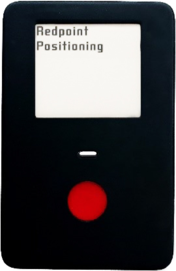
The devices are made for different jobs. Personnel badges can display warnings; general-purpose tags include a call button for emergency messages. Anchors have ceiling and wall mounting options, including an IP65 version for harsher spaces. Choosing the enclosure is part of choosing the system.
A robot fleet need not freeze
Consider another problem described in Redpoint’s AGV case study. When crews enter a robot operating area, stopping the entire fleet protects people but interrupts work. Redpoint streams live crew positions to the fleet controller, enabling robots to slow, yield or reroute around them. Central dispatch can also reallocate tasks around the people present.
The company reports 99.5% system reliability in that case study and coverage of more than 40,000 robots across deployments. The underlying idea is selective intervention: respond where the interaction occurs. A facility’s safety strategy still has to determine what movement is acceptable; the location system supplies information for that decision.
Reported in Redpoint’s current warehouse case study.
The warehouse story is substantial. Redpoint says it co-developed its platform with a leading material-handling equipment manufacturer and now operates across more than 80 Amazon fulfillment centers. It reports 98% of preventable forklift incidents avoided and a 14-month average payback. These are the company’s deployment results, with the conditions of those sites attached.
There is a useful wrinkle in the numbers. Alongside its headline precision claim, the warehouse case study reports 99% of positions accurate within one meter in live conditions. A buyer should ask for that sort of distribution, together with response times and site geometry. The decimal place on a brochure cannot describe an entire aisle.
Buy a warning, then a map
Redpoint offers three stages. Standalone tags warn people and drivers about their relative distance without a fixed network. Add an anchor and connected infrastructure to collect events, send messages and update devices remotely. A full RTLS adds the anchor network needed for facility-wide positioning, maps and historical analysis. The same tags carry through the stages.
Tags talk to tags
Relative-distance warnings for people and vehicles. No fixed network required.
The software has similarly practical jobs. SitePlan configures coverage, floor plans, users and zones. SiteWise shows live activity, heatmaps and spaghetti diagrams, the wonderfully unglamorous name for drawings of actual travel paths. SiteMonitor watches infrastructure and server health. Hosting can be cloud-based or on-premises; REST and WebSocket APIs connect other applications.
Beyond collisions, movement data offers less dramatic rewards. Managers can find a misplaced asset, examine repeated detours or identify a bottleneck. Two-way messaging lets them send instructions to personnel badges. The same position stream can therefore serve the supervisor planning tomorrow and the operator dealing with today.
This is a business selling to operations teams and equipment makers. Its partner program separates OEMs, system integrators and service providers. Stanley Ventures invested in June 2017; a BHY-led consortium supplied Series A-1 funding that October. In that announcement, Duan said: “We will continue to rely on partnership to bring the products into new market sectors.”
The distinction between products matters during deployment. Automatic vehicle intervention needs compatible controls and the correct integration; putting tags on a fleet does not complete that work. Likewise, a warning network and a mapped facility answer different questions. Buyers need to specify the behavior they expect.
The tunnel changes the arithmetic
In an August 2026 tunnel case study, Redpoint describes helmet-mounted tags tracking workers along an active highway construction project. It reports sub-meter accuracy and a 98% ranging success rate with anchors more than 400 meters apart. Fewer anchor locations can mean less equipment to install and maintain. That deployment’s spacing is not a promise for every building.
The transferable lesson is modest and useful. Pick an interaction worth changing, then test the whole chain in its actual setting: device, position, warning or control, and operating result. Count interruptions and wasted travel alongside safety events. Redpoint’s appeal lies in making location answer a working question. Where is the person, and what should the machine do now?