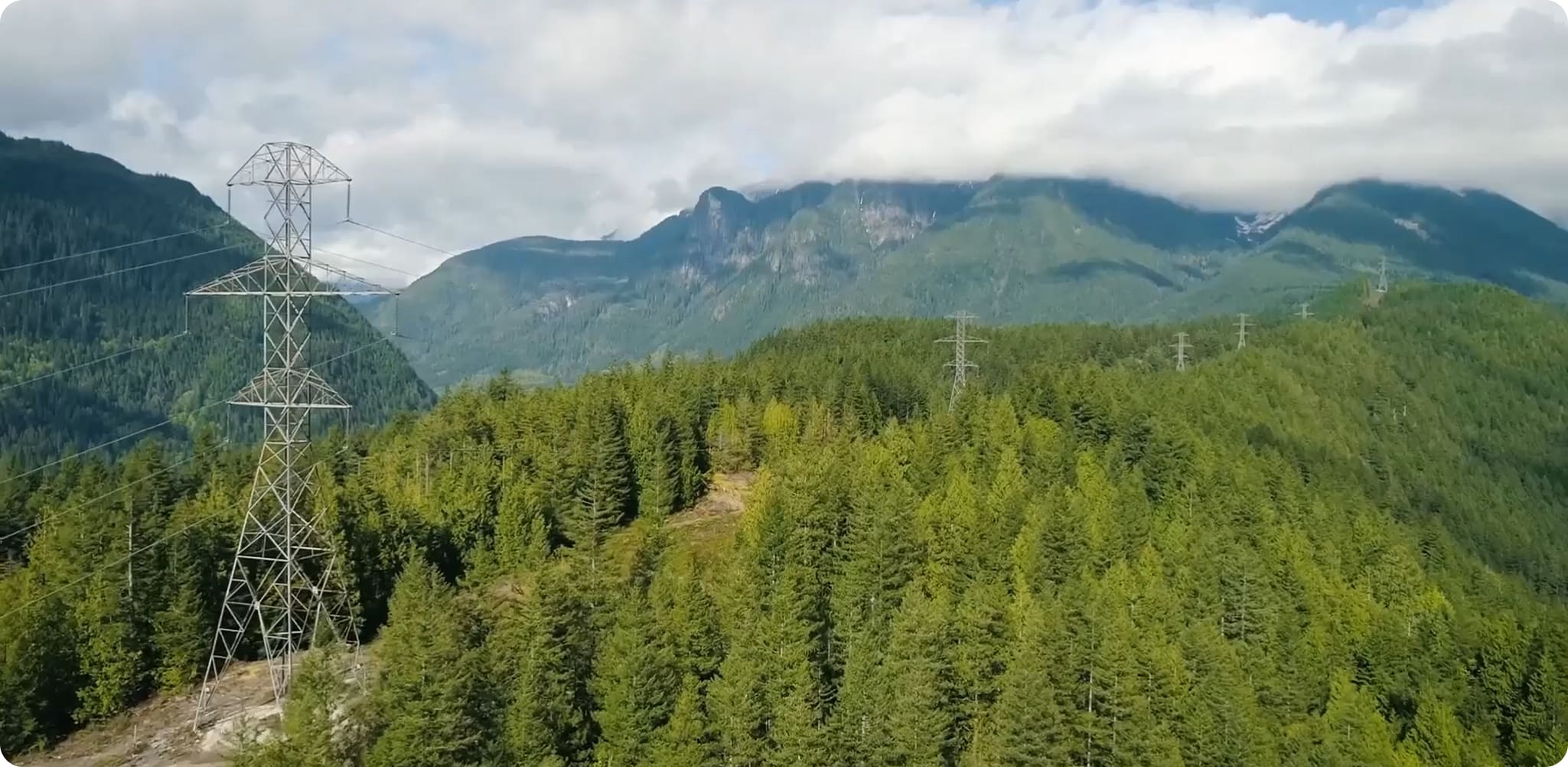
A power line looks serene from the road: a sequence of towers, a few wires, perhaps a red kite being professionally unimpressed. To NM Group, it is a moving geometry problem. Conductors lengthen in heat and sag. Wind pushes them sideways. Trees grow toward them and, less politely, sometimes fall from outside the right-of-way. The ground rises, rivers flood and the paper records back at headquarters may be older than the equipment they describe.
The company sends up crewed aircraft, helicopters and other sensors to capture the scene with LiDAR and high-resolution cameras. Then its geospatial specialists classify the resulting point cloud, its engineers build and test power-line models, and its software puts the evidence in front of the people who decide what to inspect, cut, repair or uprate. The output is not really a map. It is a queue of defensible decisions.
The point cloud is only the opening act
NM Group began in Knaresborough, North Yorkshire, in 2007 with roots in the power sector. The narrowness matters. A general survey company can deliver a clean dataset. NM Group's proposition is that a utility needs much more: knowledge of line design, clearances, loading, regulation, vegetation practice and the awkward handoff from an analyst's screen to a crew in the field.
A typical project follows a five-part chain. First comes capture, usually LiDAR paired with imagery. Flight strips are aligned into a coherent survey. Individual laser returns are classified as ground, conductor, structure, building or vegetation. Engineers reconstruct the line in PLS-CADD, where they can model sag and sway at operating temperature. Only then does the analysis answer the expensive question: which spans breach a clearance, which trees present a strike risk, which assets look wrong, and which constraints are limiting capacity?
That integrated chain is the distinction. Competitors can attack pieces of it: satellite companies watch vegetation, drone operators collect close-up imagery, survey firms produce point clouds, engineering consultancies make ratings, and enterprise GIS vendors manage durable asset records. NM Group keeps capture planning, processing, utility engineering, analytics and delivery inside one workflow. It can also accept data from several sensor types. The company is selling the translation layer as much as the technology.
“Technology alone doesn't solve the problem; it's the understanding of how to translate that information into operational decisions.”Peter Stirratt, Head of Sales
A tree becomes a ticket
Vegetation management shows the model at its most tangible. For Essential Energy in New South Wales, NM Group was engaged to map and analyse risk around nearly 85,000 kilometres of overhead line spread across almost 160,000 square kilometres. Rather than treating every branch equally, the analysis could measure clearance, identify trees capable of falling into conductors, estimate growth and rank work. The utility received the result through Caydence, the company's browser-based 3D environment.
A smaller 2024 episode makes the workflow easier to picture. During an annual survey, NM Group identified a possible critical encroachment and delivered its location, dimensions and visual guidance within 24 hours. The utility sent a crew, which cleared roughly 110 square metres of vegetation over about 22 metres of one span. A month later, another flight caught the same place. The new scan did not merely show a tidier corridor; it measured and documented that the work had been done.
What failed first was not the aircraft or the algorithm. It was the comfortable assumption that a periodic patrol and a broad cutting cycle reveal the right priority. A risk-ranked model changed the sequence: detect, locate, intervene, verify. That loop is copyable. A utility does not need to digitise its entire estate on day one. It can begin with one costly problem, define a measurable threshold and a response owner, then preserve the capture so other departments can reuse it.
Caydence turns a survey into a shared memory
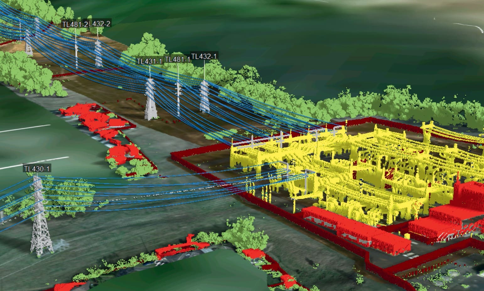
Caydence exists because conventional corporate GIS is good at being a governed system of record and less comfortable streaming hundreds of gigabytes of point-cloud detail. Some survey facts are also perishable. Today's tree position and conductor geometry matter urgently, but they do not belong forever in the same ledger as a pole's asset ID. Caydence sits alongside those systems, joining LiDAR, imagery, GIS, inspection records and bespoke analysis in a navigable 3D scene.
The more interesting benefit is organisational. UK Power Networks initially collected aerial LiDAR under a multi-year vegetation program. Years later, the stable parts of those captures - terrain, buildings and structures - were still useful. Planning and connections teams could inspect a site from a desk, test where a substation might sit and rule out a flood zone before commissioning another survey or meeting a landowner. The data changed purpose because access widened.
“Having the 3D visualisation of the land allowed me to rule out flood zones associated with the river almost instantly.”Network Planning Engineer, UK Power Networks
| Utility question | Old default | NM Group workflow |
|---|---|---|
| Is that tree dangerous? | Patrol, photograph and interpret in the field | Measure clearance and fall-in risk, then send the location to the crew |
| Can this line carry more? | Use a conservative static or seasonal rating | Model the conductor, limiting clearances and ambient conditions |
| Where can this asset go? | Commission a site visit early | Screen terrain, access and constraints in a reusable 3D survey |
| Did the work happen? | Close a task from notes and photographs | Compare captures and quantify the changed corridor |
Capacity hiding in the weather
NM Group also looks for capacity in existing metal. A line rating is partly a thermal judgment: as current heats a conductor, it elongates and moves closer to whatever sits below. Static ratings use conservative weather assumptions. Ambient-adjusted ratings recalculate against temperature and solar conditions, while dynamic ratings can add wind and real-time inputs. NM Group says its engineering work can identify up to 15 percent more line capacity in some cases without new-build capital. Its own FERC 881 explainer illustrates ambient adjustments producing up to 20 percent more ampacity than a fixed static rating in one example.
Caydence AAR packages that logic for North American operators responding to FERC Order 881. The product uses an IEEE 738-compliant algorithm, produces hourly ratings, supports real-time monitoring and can connect to a utility energy management system through an API. It is enterprise software attached to a specialist engineering service, not a consumer-style app. NM Group's commercial model mixes bespoke survey and analysis projects, repeat framework programs and software access. Prices are negotiated rather than posted.
The limits are physical, which is healthy
Remote sensing rewards precision about the question. Satellites cover enormous areas but cannot yet match LiDAR for fine clearance and structure measurements. Drones are economical for repeat inspection of a small target; crewed aircraft are faster over vast networks. Weather, airspace, foliage and the required resolution shape the capture plan. Near Gatwick in 2017, one NM Group crew began work around midnight because controlled-airspace restrictions made that the workable window.
The model also weakens when a utility cannot maintain asset references, agree risk thresholds or put a crew behind an alert. Fresh data without an operational owner becomes a sharper picture of the same backlog. And predictive analytics need history worth learning from. NM Group's vegetation work in Australia reported an 80 percent success rate when tested against historical tree failures, an encouraging result that still leaves room for human checking and local knowledge.
A company reacquainted with its centre
Trimble acquired privately held Network Mapping Group in May 2017, adding its modelling, analytics and Caydence visualisation to a larger utility portfolio. Financial terms were undisclosed. In 2023, NM Group announced that the companies had parted ways, saying independence would let it focus on aerial LiDAR, geospatial processing, PLS-CADD modelling, analytics and Caydence. The same year, Kostas Lopsaitis - at the company since 2011 - became chief executive.
That return to the centre looks deliberate. NM Group now describes itself as network intelligence for critical infrastructure and says it has delivered more than 1,000 projects in Europe, North America and Australasia. Customers named in its public work include National Grid Electricity Transmission, UK Power Networks, Hydro One, Essential Energy, Endeavour Energy and Western Power Distribution. National Grid has called it a trusted partner of a decade; some company relationships now stretch beyond 17 years.
The market around it is becoming crowded with satellite monitoring, AI inspection and digital-twin pitches. NM Group's answer is pleasingly unfashionable: use every sensor for what it is good at, keep an engineer in the loop and make the result comprehensible to the person with a maintenance budget. Its Head of Sales has said there is no single silver bullet. Its Chief Delivery Officer recently warned that opaque automation can produce “artificial incompetence” in safety-critical work.
That restraint may be NM Group's best sales argument. Electricity networks do not need software that sounds certain. They need evidence that survives a regulator, a storm and a field crew standing beneath the wire. The laser sees millions of points. The business is deciding which one matters.