Some executives arrive at marketing through slogans. Marianna Kantor arrived through systems. Before she became Esri's chief marketing officer, her working life moved through electrical engineering, systems engineering, a national laboratory, internet infrastructure, and enterprise software. The path helps explain the unusual texture of her argument today: the world may be filling with artificial intelligence, but intelligence becomes useful only when it understands where it has landed.
“Where” looks like a small word. It is also the word that connects a spreadsheet to a flooded road, an inventory forecast to a distribution center, a customer profile to an actual neighborhood, and a beautiful digital model to the stubborn physical world. Kantor's job is to make that connection legible. At Esri, the geographic information systems company, she leads global marketing and communications and writes about maps as decision tools for people who may never call themselves mapmakers.
Her case is not that every executive needs a cartography hobby. It is that every organization already has a geography. Customers, equipment, stores, cables, coastlines, airports, forests, and supply chains occupy space. Risk travels across that space. So does opportunity. The map is where separate facts can finally meet.
The translator at the table
Kantor studied electrical engineering at Columbia University, systems engineering at the University of Pennsylvania, and business at MIT Sloan. Her early career included a leadership role at Los Alamos National Laboratory. Product and marketing work followed at Akamai, PTC, MathWorks, and other technology companies. It is a résumé built around complicated things that need to work, scale, and be understood.
That combination matters because enterprise technology has a chronic translation problem. The builders speak in architecture, models, and capabilities. The buyers speak in growth, cost, resilience, and risk. Neither language is wrong; neither is sufficient alone. Kantor has described the people who can move between analysis and executive value as “spatial business transformers.” The phrase is clunky in the charming way that new professional species often are. The role itself is crisp: make the insight count.
“Esri software can truly impact the way decisions are made.”Marianna Kantor, early in her Esri tenure
A revealing moment came near the beginning of her time at Esri. Speaking during the company's annual user conference, she worried about “banner blindness,” the glaze that settles over an audience after it has seen the same broad promise too many times. Her answer was not another adjective. Esri, she argued, had to design stories that reached commercial audiences and prove the value at every touchpoint. Public agencies already understood many uses of GIS; businesses needed to see how a map helped make money, save money, or make a better decision.
It is the practical spine of her work. Start with the stakes. Show the system. Connect it to a decision. The software earns attention by illuminating something the audience needs to do.
A mirror world needs an address
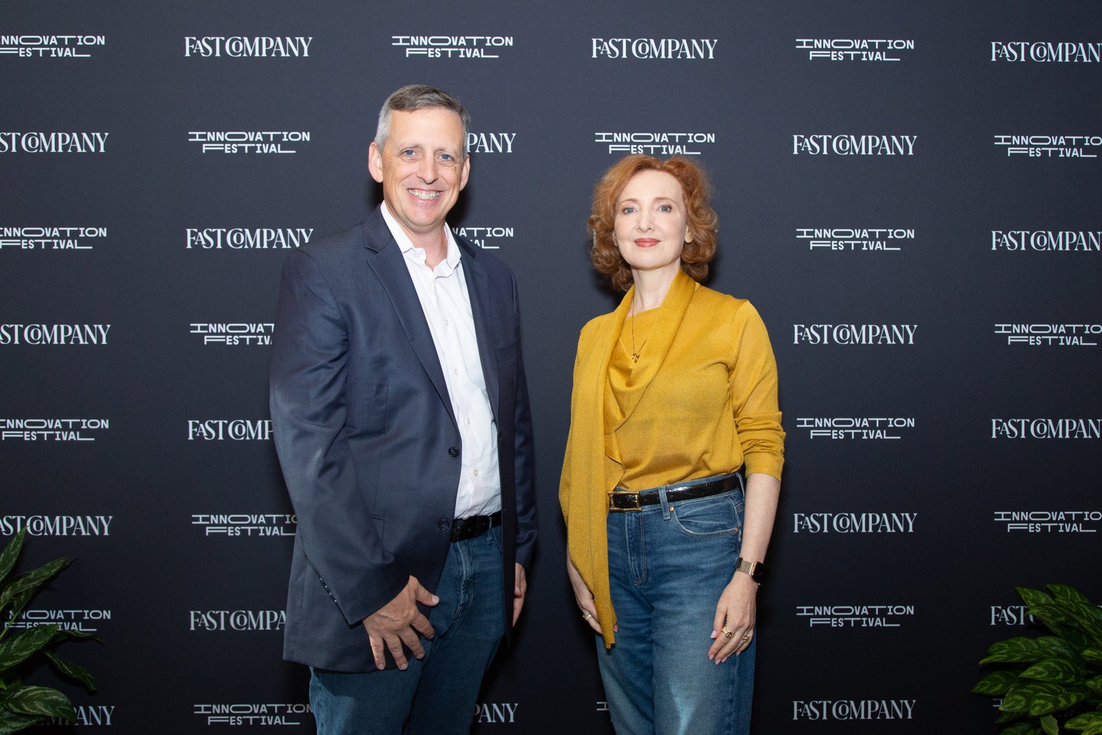
At the 2025 Fast Company Innovation Festival, Kantor sat down with editor Ben Baer to discuss digital twins. The phrase can summon a glossy sci-fi duplicate of a city. Her explanation was more useful. A digital twin, she said, contains the thing itself, its behavior, its context, and the relationships that connect those elements.
The four-part mirror
An airport, building, vehicle, network, or operation.
What it is doing and how that changes over time.
Terrain, weather, people, infrastructure, and place.
How each part affects the others.
Context is where geography stops being decoration. Consider an airport. A useful model must know more than the location of a gate or utility line. It needs the relationships among travelers, maintenance crews, emergency teams, merchants, aircraft, and facilities. Their needs overlap in one dense physical system. Put those relationships on a shared map and a digital twin becomes less like a picture and more like a rehearsal room. Leaders can test scenarios before reality charges admission.
Kantor has described the promise in brisk executive terms: digital twins can help businesses do things “faster, cheaper, and better.” The interesting word is not any one of those. It is “and.” A well-built representation lets teams see tradeoffs together. Speed without context may create expensive mistakes. Savings without relationships may move a problem to somebody else's column. Better depends on seeing the system whole.
AI knows what. Geography knows where.
Her more recent writing extends the same logic into artificial intelligence. AI systems can process large amounts of information, but a plausible answer can remain detached from the world. An optimal route that ignores a closed bridge is not optimal. A risk score that misses a floodplain is missing the risk. A retail forecast without the distance between homes and stores may understand customers without understanding shopping.
Geospatial AI adds terrain, weather, infrastructure, boundaries, movement, and proximity. It grounds the model in conditions that have coordinates. Kantor's formulation is memorable because it avoids treating location as an exotic specialty. Every delivery address proves the point. Every asset register quietly wants to become a map.
The chart is conceptual, not a measurement, and its final line matters. Kantor's public posts in 2026 have returned to the human qualities that remain valuable as machines grow more capable: curiosity, courage, creativity, compassion, and communication. In her image of the future, people become conductors of powerful cognitive systems. The orchestra may play with formidable speed. Someone still has to choose the piece, hear when the sections drift apart, and decide what the performance is for.
A model can be technically persuasive and still be geographically wrong.
The map as common language
Across Kantor's articles, the subjects roam: climate resilience, customer behavior, ocean sustainability, government modernization, advertising, digital divides, circular economies. The connecting thread is not the industry. It is the decision. A company has scattered evidence and a consequential choice. Geography provides a surface on which the evidence can become visible together.
That visibility can change who joins the conversation. A technical analyst can show a pattern without converting it into a page of equations. An executive can point to an exposed facility. An operations team can challenge an assumption with local knowledge. A map gives different disciplines an object to disagree over productively. Few meetings are improved by another abstraction. Many are improved by being able to point.
A transferable lesson for marketers sits inside this approach. Translation is not the removal of sophistication. It is the careful arrangement of sophistication around a human decision. The audience does not need every feature at once. It needs to recognize its own problem, understand the consequence, and see a credible route forward.
Her archive also suggests an appetite for the overlooked edge of ordinary business. She has written about billboards in a digital advertising market, pop-up shops, salaries adjusted for location, consumer traffic, privacy, ocean commerce, and the placement of public services. These are not variations on one campaign. They are demonstrations of a habit: take a familiar activity, add spatial context, and watch the assumptions move. A billboard becomes a question about audience and movement. A salary becomes a question about cost of living. A climate target becomes a portfolio of facilities, suppliers, routes, and communities. Geography does not make the decision automatic. It makes the hidden variables harder to ignore.
Her engineering background makes the message feel less like a campaign and more like a method. Systems have parts. Parts have relationships. Relationships create outcomes. Marketing, at its best, reveals that structure without burying the person who must act.
A career drawn in layers
Kantor's career looks coherent in retrospect: an engineer learns to read systems, a technology operator learns how products meet markets, and a CMO learns to make an invisible infrastructure visible. Yet the neat line is less interesting than the repeated crossing of boundaries. Laboratory and boardroom. Technology and narrative. Public mission and commercial return. Data and place.
In 2021, she was included among Women We Admire's Top 100 Women Leaders in Technology. Colleagues writing publicly about her have emphasized curiosity, analytics, demanding standards, and a willingness to challenge organizational inertia. One recalled her introducing performance dashboards and shifting how a long-established company understood marketing. Measurement was not an afterthought. It was part of the argument.
That approach can sound severe until one notices how often her work is about making room for other people to see. The analyst gets a language for value. The executive gets a picture of complexity. The customer story gets to carry more weight than a polished claim. The map is never merely the star; it is the table around which the cast can gather.
The next chapter of that work is already visible. AI will produce more answers, more quickly, and with increasing confidence. Digital twins will offer seductive mirrors of factories, cities, networks, and businesses. Kantor's contribution is a disciplined question to place beside all that intelligence: does the model understand where reality is?
It is a modest question with a habit of enlarging the room. Ask it and the weather enters. Roads enter. Communities, assets, ecosystems, regulations, distances, and consequences follow. Suddenly the business problem has a landscape. Someone unfolds the map. The meeting can begin.