Somewhere along a power line, a tree has become a question of centimeters. To the casual eye it is one more tree in one more long corridor. To a utility crew it may be the next place to send a truck. GreenValley International describes a survey of 2,500 kilometers of power corridor in which LiDAR data and its software identified 40 hazard points. The interesting number is not the length of the corridor. It is 40: a field problem compressed to a list a human can act on.
- GreenValley sells airborne, handheld, backpack and vehicle-based 3D mapping systems, plus the software that processes their data.
- Its tools serve surveyors working in power, forestry, terrain, mining and road infrastructure.
- The company’s edge is the connected workflow: collect points, classify them and deliver a specific answer.
A LiDAR scanner measures the world as a cloud of points. That cloud can be extraordinary to look at, but it is seldom a finished job. A utility wants clearance between wire and branch. A forester wants individual tree measurements. A road authority wants assets in a database. A mine operator wants a stockpile volume. Each must pass through the same awkward middle: cleaning, aligning, classifying and interpreting an enormous quantity of coordinates.
The invisible middle of the survey
GreenValley, founded in Berkeley in 2012 by Qinghua Guo, built a catalog that follows the surveyor into that middle. LiAir systems go into the air; LiGrip can be carried by hand; LiBackpack travels on a person’s back; LiMobile rides on a vehicle. LiDAR360, launched in 2013, processes point clouds and imagery into terrain models and specialized analyses. LiDAR360MLS handles data from moving platforms and extracts objects for uses such as road inventories and architectural drawings. The family resemblance is deliberate: each product is another entrance into the same data workflow.
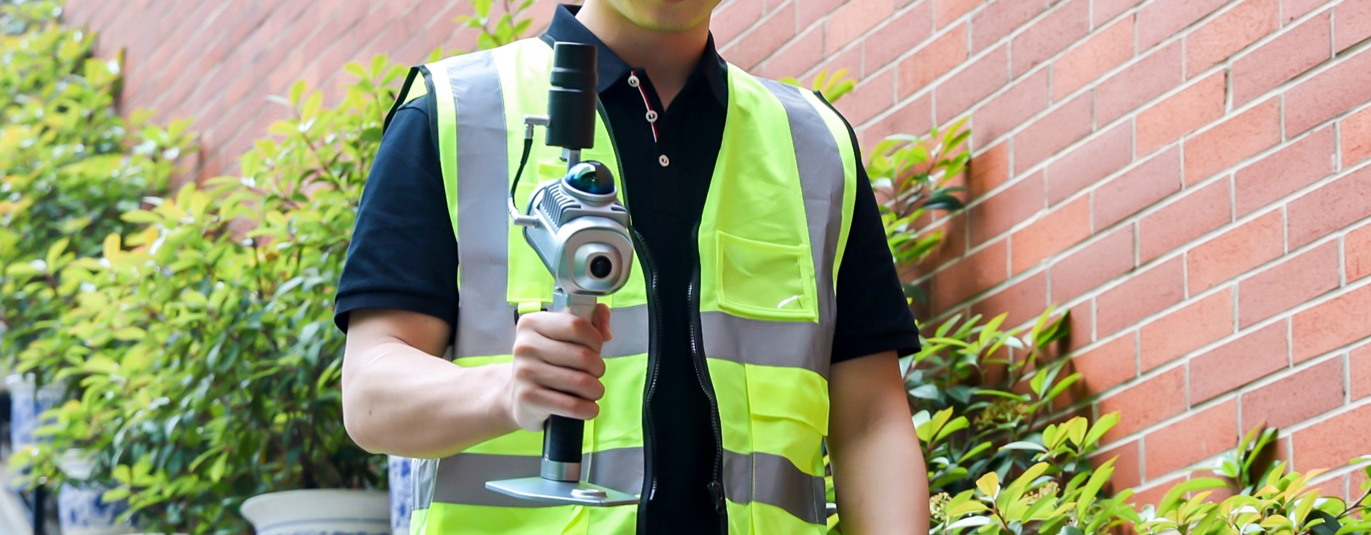
The handheld LiGrip O1 Lite illustrates the pitch in miniature. GreenValley lists SLAM, RTK-SLAM and PPK-SLAM modes, which give operators different ways to track position while moving through a site. The company lists the unit at one kilogram, with a 70-meter scan range and a 200,000-point-per-second scan rate. Those numbers matter in the field. They say less about whether the final drawing will be trusted. That depends on how the scan is positioned, checked and turned into an output.
A corridor becomes a to-do list
In GreenValley’s published powerline case, airborne scanning came first. The point cloud then went into LiDAR360, where the software classified ground, towers, wires, buildings and vegetation. The user specified safety distances. The system could flag vegetation or sagging conductors and generate an inspection report. The case describes 40 hazardous points across 2,500 kilometers, including a location where clearance was 0.76 meters beyond the chosen vertical threshold. Those figures are the company’s case-study results, not a universal performance guarantee.
This is a good example of what the buyer pays for. The scanner collects evidence; the software supplies a method for ranking it. The precise threshold is set for a particular job, and the result still requires professional review. But the arithmetic of attention changes. Instead of asking crews to look equally hard at every span, an operator can focus on places the data suggests deserve a closer look.
The value of a map can be measured by the number of places it tells you to inspect.
A software company wearing a scanner
At a Berkeley user meeting in 2024, a LiMobile system rode on a minivan, while a LiAir payload flew on a DJI drone and handheld and backpack systems were demonstrated. LIDAR Magazine’s account makes a useful distinction: GreenValley integrates equipment from other makers rather than manufacturing the drone, LiDAR sensor, camera and GNSS receiver itself. The company views software as its center of gravity. Its LinkedIn page names RIEGL and Livox among sensor partners.
That position separates it from a pure sensor maker and from a firm that only processes someone else’s data. A buyer can start with GreenValley hardware and stay in its software, but LiDAR360MLS documentation also describes support for data from third-party mobile mapping devices. The promise is continuity without insisting that every object in the kit carry one badge. The practical test is less romantic: whether the combination handles a survey’s coordinate systems, accuracy checks, formats, computers and delivery requirements.
Its commercial model follows the shape of its product line. GreenValley sells mapping systems and licenses software by module and plan. Its online LiDAR360 store lists annual and permanent subscription options, with separate modules for terrain, forestry, mining, buildings, photography and distributed computing. Public pricing on that page changes with selections and is not a reliable single sticker price. A seven-day trial is advertised for major software versions. Hardware buyers can also reach the firm through dealers and distributors; Frontier Precision joined its North American partner network in 2020.
Who needs a more particular map?
The answer ranges from forest plots to parking garages. LiDAR360’s forestry tools can segment individual trees and calculate attributes such as height and diameter. Terrain tools classify ground and produce elevation models and contours. Mining workflows calculate volumes and analyze slopes and tunnels. The mobile software works toward road asset inventories, vector maps and building drawings. These are different markets sharing a common raw material: measured space.
That breadth is attractive to an organization that surveys several kinds of sites, or to a service provider selling different deliverables from similar field skills. It can also be a complication. A powerline team has little use for a mining module; a small surveying practice may care more about one dependable workflow than a long menu. GreenValley’s modular licensing recognizes this. The clearest buying question is the one the corridor case answers: what specific decision should the scan support?
The company has kept updating the processing side. Recent documentation describes LiDAR360MLS tools for point-cloud measurement, feature extraction and AI-assisted classification. LiDAR360 V9 release notes record fixes to classification, terrain and forestry tools. The steady detail of those notes is instructive. Survey software lives or dies in the unglamorous exceptions: a coordinate shift, a stalled progress bar, a tree table that fails to refresh. A beautiful point cloud cannot redeem a wrong contour.
The portable lesson
The most useful thing to copy from GreenValley is a way of framing a technical product. Begin with the answer the customer needs, then work backward through the data required to produce it. If the customer needs a vegetation warning, define the clearance rule and the review process before debating scanners. If the customer needs a mine volume, agree on the reference surface before measuring millions of points. The capture device matters; so does every assumption after capture.
GreenValley occupies a practical corner of the 3D mapping market: the place where sensors, survey workflows and industry software meet. Its scanners make the world legible to a computer. Its real wager is that a company will pay more for a map that knows what question it was meant to answer.