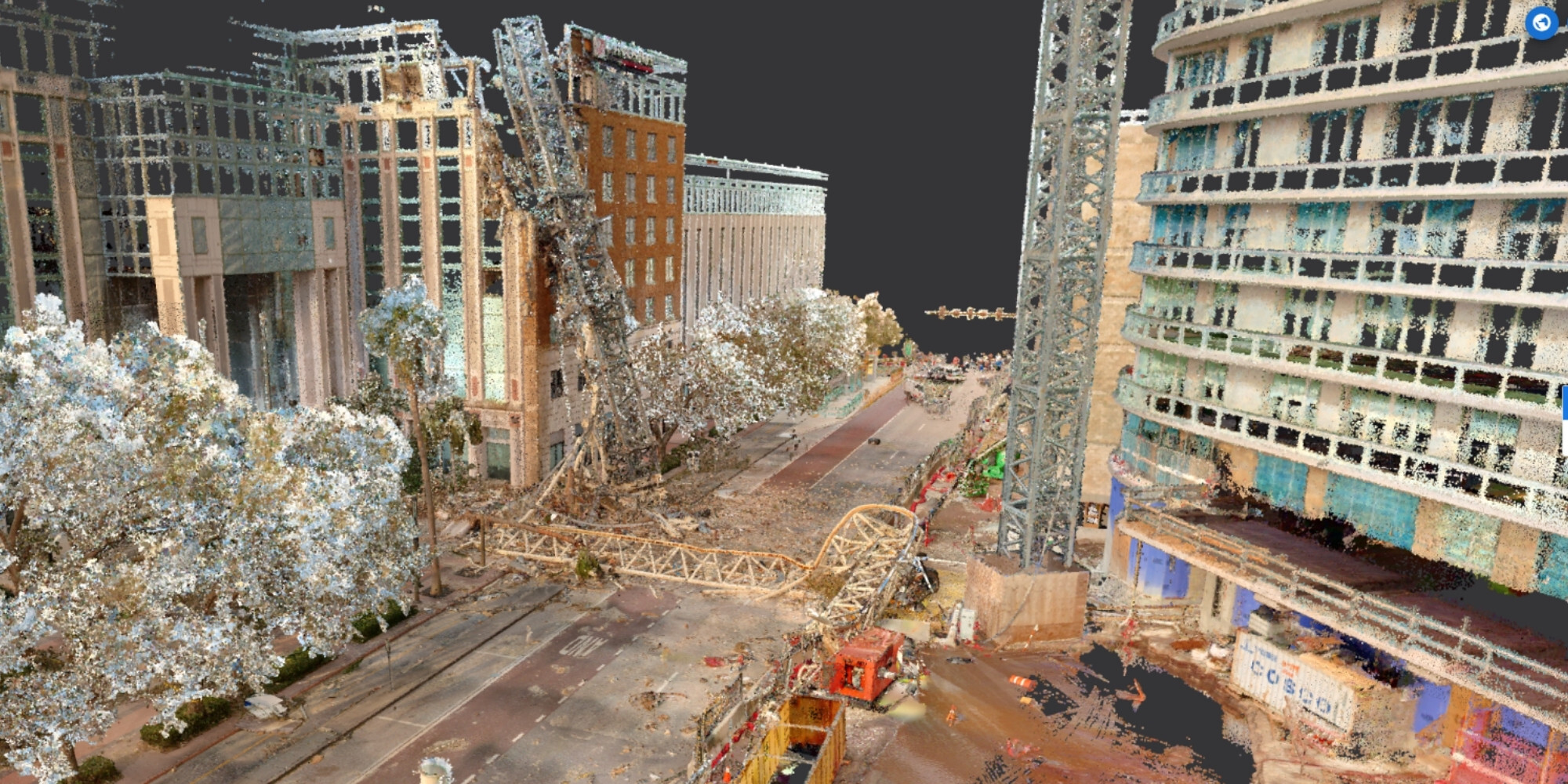
After Hurricane Milton, George F. Young received a request for pictures. The surveying and engineering firm proposed something more useful: scan the site while taking them. Within 24 hours, it delivered spatial data to help emergency response and coordination. In the resulting point cloud, damaged streets and fallen structures could be examined again without sending another person into the scene.
That is a good place to meet NavVis. A photograph records what someone chose to look at. A measured digital environment lets the next person ask another question. For a surveyor, an engineer, or a factory planner, that distinction can decide whether tomorrow begins at a desk or in a car.
- Mobile laser scanners capture buildings and sites as operators move.
- IVION puts the resulting spatial data in a browser for shared inspection.
- The business case rests on fewer repeat visits and data that earns its keep twice.
A building is a moving target
The nuisance with a factory drawing is that the factory has no obligation to obey it. Machines move. Production lines change. A drawing can be beautifully maintained and still describe a place that no longer exists. NavVis sells a way to check the difference: capture existing conditions, process the measurements, and make them accessible to the people making decisions.
Its scanners combine laser measurements with panoramic imagery. Simultaneous localization and mapping, usually shortened to SLAM, estimates the operator’s position while building the map. The result is a point cloud: many measured points describing surfaces in three dimensions. Photographs supply the visual context that helps someone recognize what those points belong to.
This places NavVis between specialist surveying equipment and enterprise software. Leica and FARO are alternatives for parts of the scanning job; Matterport and HoloBuilder overlap in visual documentation. NavVis’s distinctive proposition is the combination of capture in motion and an accessible workspace for the data. The right comparison depends on the required detail, the site, and who needs the deliverable.
The map found a better customer
The company’s beginnings were narrower. During a 2007 research stay at Stanford’s GPS Lab, Georg Schroth developed an idea for indoor positioning using computer vision. The work continued at the Technical University of Munich. In 2013, Felix Reinshagen joined Schroth, Robert Huitl, and Sebastian Hilsenbeck to found NavVis.
The difficulty, Reinshagen later told KfW, was finding a suitable market for university research. Indoor navigation supplied the starting question. Industrial customers supplied a larger one: could teams inspect and plan a building without gathering inside it? Reinshagen brought fundraising, organization building, and early customer acquisition; his co-founders developed the underlying technology and products.
The pandemic made remote factory access more compelling, according to that interview. Travel restrictions gave managers a practical reason to try a digital copy. NavVis’s collaboration with BMW illustrates the scale: a 2022 announcement described nearly four million square meters scanned since November 2020, with thousands of employees accessing the resulting data.
The walk is only the first act
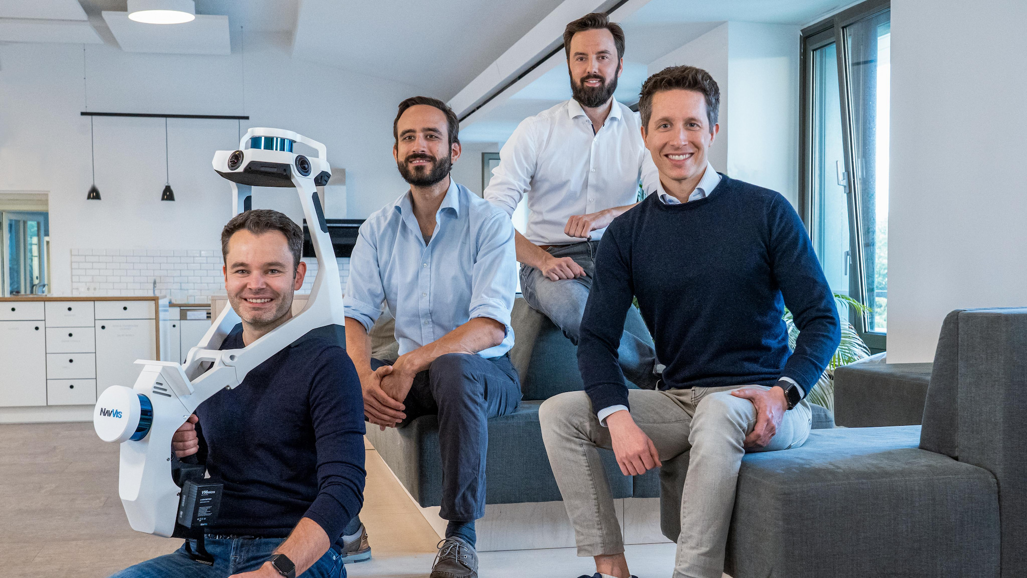
The hardware now offers several ways to make that walk. VLX 3 is wearable. MLX, introduced in 2024, is handheld, with a supporting harness and live scanning feedback. Its form makes it useful in confined spaces. Both belong to workflows that can incorporate measured control points rather than treating a scanner’s own estimate as the final authority.
September 2026 brought two additions. CLX targets frequent, routine documentation, including site assessment and LOD200 Scan-to-CAD/BIM work. VLX 4 targets finer detail, with NavVis advertising a native three-millimeter point-cloud resolution for demanding building-model and mechanical, electrical, and plumbing applications. Resolution describes captured detail; it should not be mistaken for an unconditional accuracy guarantee.
IVION handles the next act. In a browser, teams can inspect a site, measure, tag assets, and visually compare models with captured conditions. Its integrations include Autodesk tools and TopoDOT. A scan becomes useful to people who neither carried the instrument nor know how to operate specialist point-cloud software.

What happens to the invoice?
NavVis earns money from hardware, software subscriptions, processing packages, and services. IVION has Core, Professional, and Enterprise plans; licensing accounts for panoramas, storage, and registered users. Processing uses a separate volume-based unit system. Customers can buy IVION independently of NavVis hardware, so the software’s usefulness need not end at the scanner brand.
The customer economics are more revealing. George F. Young reports that some projects fell from weeks of fieldwork to a day. Substation scan deliverables cost less than 15 percent of the traditional approach, and the scanner paid for itself within months. These are selected customer results published by NavVis, not promised savings for every buyer.
“Now we sell a product.”Trevor Hatch, VP of Survey, George F. Young
That short observation contains a business lesson. If the deliverable can serve several departments and future questions, billing only for the original field hours misses part of its value. A firm can copy the approach by choosing a repeatable job, measuring the whole delivery cost, and packaging data so clients can use it again.
The detail that still needs a human
Speed does not settle every surveying question. George F. Young still uses total stations for work such as tying into existing utilities. NavVis’s VLX 3 specification gives five-millimeter local accuracy in a dedicated 500-square-meter test environment; absolute accuracy depends on the environment’s size and survey control. Checks and benchmarks remain part of the job.
Nor does a digital twin refresh itself merely because it has an impressive name. NavVis introduced an IVION rescan workflow in 2024. Someone still needs to decide when conditions have changed enough to justify another capture. The product is most useful where shared access and repeat use repay that maintenance effort.
In August 2026, NavVis announced an $85 million Series D led by The Jordan Company to expand its spatial data engine and AI roadmap. It reports over a billion square meters captured in 2025. The wager is that better decisions about physical places begin with better records of them. First, someone has to take the walk.