Audra Lund’s problem was geography. As a lead land analyst at Enterprise Products, she helped a pipeline business research the land it needed to cross. The information existed. Getting it meant courthouse research, county offices, and time on the road. A project could span jurisdictions; the records did not politely assemble themselves around it.
In a LightBox customer account, Lund describes moving that research into LandVision, now called LightBox Vision. Her team could combine property information with its own pipeline, valve, and facility data. Travel and courthouse fees fell as onsite research declined. Other departments could see the same information. A map had become a shared working document.
- LightBox connects property records that arrive in different formats from different places.
- Its software serves the people finding, assessing, financing, and marketing real estate.
- The practical payoff is less record chasing before a decision.
First, agree on the property.
Consider an ordinary street address. It might point to a building on several tax parcels. A parcel might contain several buildings. The owner on the deed might be a company whose name tells you very little. Environmental records, zoning rules, and appraisal files add more versions of the same place. Before anybody models the investment, somebody has to reconcile the nouns.
This is LightBox’s territory. Its data business connects parcels, structures, addresses, assessment information, ownership, transactions, and other layers through the persistent LightBox Identifier. SmartFabric supplies foundational connected data. Customers can use a mapping application, query APIs, receive bulk feeds, or bring information into systems such as ArcGIS and Snowflake. The expertise sits in collecting, standardizing, and relating records across jurisdictions.
A useful illustration comes from Pivotal Analytics, a healthcare business intelligence company. It needed to connect claims addresses with physical properties to help evaluate healthcare locations. In its published account, the deciding factors included LightBox’s structured data and willingness to help with matching. Pivotal used SmartFabric, the Geocoding API, and LandVision. The map mattered because the matching worked.
A company assembled around the paperwork.
Eric Frank formed LightBox in 2018 with backing from Silver Lake and Battery Ventures. That year, the investors agreed to buy Environmental Data Resources, or EDR, from Daily Mail and General Trust for $205 million. That number describes the EDR acquisition. It should not be mistaken for LightBox’s valuation or a startup funding round.
EDR brought environmental information and due diligence workflows. ExactBid added appraisal procurement technology. In 2019, LightBox added Real Capital Markets, a commercial property marketplace, and Digital Map Products, the mapping business behind LandVision. Terms of those two transactions were undisclosed. BuildingFootprintUSA and cash-flow modeling business Assess+RE followed in 2021; zoning specialist PZR joined in 2022.
Read the acquisitions as a sequence of jobs. Find a property. Understand its boundaries. Investigate its history. Check what can be built. Order an appraisal. Finance it. Market it. LightBox bought businesses already doing those jobs, then pursued connections between their information and customers. That is the strategic logic visible in its company history, rather than evidence of an overnight invention.
“Everything can be done in-house, faster.”
Audra Lund / Enterprise Products
LightBox customer case study
The map earns its keep.
For a developer, an attractive patch of land is the beginning of a list of questions. A Toll Brothers case study describes using LandVision to assess ownership, flood plains, school boundaries, transaction history, and other site characteristics. Finding several parcels connected by ownership can reveal a potential development opportunity that a single-property search misses.
For a lender, the questions become procedural. Collateral360 brings appraisal procurement, environmental reports, vendor oversight, and policy-based workflows into a dashboard. Environmental professionals use EDR resources and LightBox Live to compare historical material with current property intelligence. PZR handles zoning research. Brokers have mapping, RCM marketing and marketplace tools, and ClientLook CRM. Different desks, different tasks, overlapping property records.
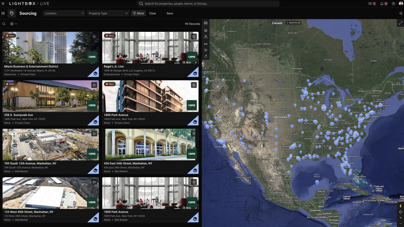
The company also sells beyond the brokerage office. Its June 2025 California announcement expanded a long-running relationship through the Department of Technology, supporting state agencies with LightBox Vision and LightBox Data. Property information can help coordinate government work as well as private investment. LightBox reports more than 30,000 customers across commercial and government sectors.
Sell the shorter route.
The business model follows the work: software subscriptions, licensed datasets, API access, reports, and services. The delivery options matter. A GIS analyst may want layers in ArcGIS; a software team wants an API; a broker wants a usable screen. LightBox can sell the underlying information through several doors without asking every customer to become a data engineer.
It has company in this market. CoStar offers commercial property research and public records; Reonomy connects property, transaction, and ownership intelligence for research and prospecting. LightBox’s particular argument is the combination of location data, environmental history, zoning, and professional workflows. Whether that combination is useful depends on the job. A buyer needing one ownership search has different requirements from a bank coordinating reports across a portfolio.
Watch the handoffs.
A July 2026 webinar demonstrated LightBox Live for investors, moving from opportunity discovery toward underwriting preparation, including document-to-Excel workflows. It is a revealing direction: keep the information moving into the tools where investment work happens.
The limits deserve equal attention. A unified record still depends on source quality and update timing. A map cannot settle every site-specific question, and screening does not substitute for professional investigation. LightBox’s own September 2026 activity report shows another boundary: listings rose while environmental assessment and appraisal activity declined. Better information can expose a difficult market; it cannot supply a willing lender.
The lesson worth copying is modest and useful. Establish which records belong together. Put them where people already work. Then reduce the friction between one person’s answer and the next person’s question. For Lund’s team, that began with fewer trips to the courthouse. In property, progress sometimes looks like staying at your desk.