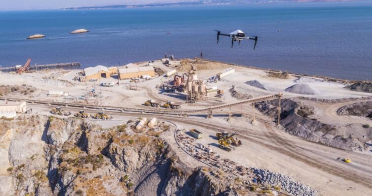
The first useful signal was a request for another photograph. Christian Sanz was flying a drone over a California construction project, collecting images he had offered to make for free. The workers did not treat the view from above as a novelty for long. They asked for particular angles. They wanted updates. Once Sanz showed them what had changed across the site, they could see decisions hiding inside the pictures.
That response gave him the evidence he needed. A drone could do more than make a dramatic video. It could become the front end of a new industrial information system: capture the physical world, rebuild it in three dimensions, and return the result while it was still current enough to matter.
Skycatch grew out of that observation in 2013. Thirteen years later, in July 2026, Caterpillar acquired the company to bring its high-frequency spatial data and artificial intelligence into the MineStar and RPMGlobal ecosystem. The visible machine was still a drone. The enduring business was the shrinking interval between an event on the ground and an informed response.
A career spent making systems visible
Sanz was born in the United States and moved to Chile when he was four. In Talca, computers became an early obsession, encouraged by his father. A summer visit to an aunt in Pennsylvania in 1991 was supposed to last a month. Sanz was 14. He saw how much more technology was available, enrolled in high school, joined the Greco-Roman wrestling team, and stayed.
After school he went to California to study computer science, then left the routine of college for the U.S. Navy. He spent four years in service, including work with shipboard communications. The experience put reliability, consequence, and information flow into the same frame. A message had a route, a recipient, and a reason to arrive intact.
Back in civilian life, he returned to school and found work in Disney research and development. Over six years he worked around 3D games, holograms, subscriptions, and software systems, eventually becoming a senior engineer. Leaving was difficult. Disney was stable, technically interesting, and came with the rare social advantage of friends always wanting to visit the park. Sanz left anyway, moving through engineering and leadership roles at LoopNet, Break Media, Kin Community, and Storify.
I love coding new products.Christian Sanz, GitHub profile
The titles changed, but the work kept returning to interfaces between messy inputs and usable outputs. At Storify, he helped build the first version's infrastructure and worked on the product after funding. In San Francisco, a new interface began to interest him: the programmable drone.
The hackathon found a job
Around 2011 and 2012, drones still belonged largely to hobbyists, researchers, and tinkerers. Sanz became involved with NodeCopter, where developers used JavaScript to control small aircraft, and created DroneGames, a mix of competition and hackathon. Graduate students and engineers from the Stanford and Berkeley orbit came to build, race, and test applications.
The events were entertaining. Sanz kept wondering where the information gathered by a flying object would be valuable enough to support a company. The promising answers were places with constant activity and expensive change: construction, mining, and industrial security.
A polished enterprise pitch would have arrived too early. Sanz needed data from a real site, and a real site had little reason to trust an unproven founder with an unproven aircraft. He bought a hard hat and work clothes, studied active projects, and entered a construction site with a drone. He later remembered being terrified that someone would stop him.
Instead, people gathered around. The aircraft was unfamiliar, but the resulting map was immediately legible. Sanz returned, built relationships with the crew, and showed them the data. The workers' reaction changed his confidence. They could see more of the job and make decisions sooner. Eventually the site learned that he was not part of the contractor's team and asked him to provide the service officially.
When paper became the product analytics
An early project connected Skycatch with Apple construction work. The operating rules restricted the casual exchange of digital files. Sanz noticed that nobody had prohibited paper. He printed dozens of maps and left them where people could pick them up.
Within a week, the pages were circulating. Workers photographed them, drew on them, wrote notes, and placed them around the office. A free artifact had entered the daily workflow. When a pilot missed a day, an Apple representative called to complain about the absent data, then learned that the daily service was not actually in the contract. The misunderstanding led to a changed agreement.
If they win, I win.Sanz on wanting mining customers to adopt the product
The behavior was clear product feedback. Usage had escaped the presentation and become a habit. The marked-up printouts also revealed what Skycatch needed to be. A beautiful aerial image could start a conversation; a repeatable map with measurements, context, and a reliable delivery time could support a job.
Five meters, five centimeters
Komatsu forced the next transformation. In 2015, the Japanese equipment company was working to automate construction and mining machinery. It needed a precise model of the terrain beneath those machines. Skycatch's early 3D maps could place an object within roughly five meters. Komatsu wanted five centimeters.
Sanz's team estimated that closing the gap could take five years. Komatsu offered a $10 million investment and a two-year timetable. Skycatch committed heavily to the project, knowing failure could erase the company. At several points, cancellation appeared possible. Sanz recalled getting on a plane to Japan when the system was delivering six-centimeter accuracy and the requirement remained five.
The Komatsu accuracy challenge
The bars show relative position tolerance: the target was one hundredth of the early variance.
The team reached the target and brought the capture-and-processing cycle down to about 15 minutes. Komatsu could distribute the system across many sites. Precision was no longer a feature attached to a drone; it was the condition that allowed spatial data to interact with heavy equipment, survey work, and automated operations.
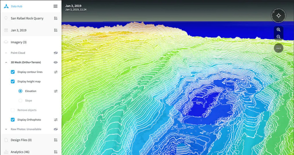
The engineering stack expanded accordingly. Drones and sensors captured imagery. Photogrammetry turned overlapping pictures into maps, point clouds, and 3D meshes. Edge computers processed large files at remote sites where connectivity could be unreliable. Cloud software organized and shared results. Machine-learning models identified features and changes. Each layer existed to make the output faster, more consistent, and easier to place inside another industrial system.
The company behind the flying object
Skycatch's path followed the unglamorous needs of industrial users. The company worked with construction groups and mining operators across continents. Its software helped teams compare current terrain with plans, calculate volumes, inspect inaccessible areas, and spot changes before later work made them expensive to correct.
In one documented use, site imagery revealed electrical conduit installed in the wrong place before concrete fixed the mistake in place. On remote mining sites, local processing shortened the wait for survey information. The common value was temporal. A model of last month's terrain is a record. A sufficiently accurate model from today can participate in today's operation.
Sanz kept coding as the company grew. His public developer profile is filled with Node.js, JavaScript, tooling, and small experiments, a useful counterweight to the abstract language of digital transformation. Skycatch's system may describe enormous mine sites, but it remains a collection of exact engineering problems: move a file, reconcile coordinates, render a surface, identify a road defect, and return the answer within the working day.
From experiment to infrastructure
A larger machine
By the 2020s, Skycatch had concentrated much of its work in mining. Sanz wrote about artificial intelligence, on-premises photogrammetry processing, and the shift from periodic surveys toward high-frequency spatial intelligence. At MINExpo 2024, the company showed EdgeServer for rapid local processing and an AI system for road analysis. It was also demonstrating integrations with Caterpillar.
The eventual acquisition has a straightforward industrial logic. Caterpillar's machines move material. MineStar helps manage equipment and operations. RPMGlobal connects planning with execution. Skycatch supplies a recent, high-resolution model of the physical site. Combined, the software can compare what planners expected, what machines did, and what the terrain now looks like.
For Sanz, the sale arrived close to the horizon he had described years earlier. In a 2022 interview, asked about an exit, he answered: three years. The calendar was off by roughly one. The direction was right.
This isn't the end of Skycatch. It's the beginning of a much bigger chapter.Christian Sanz, July 2026
His public message after the deal returned to the same operational promise that began the company: give industries accurate, near-real-time geospatial data so people can decide sooner, work more safely, and understand changing sites with greater confidence. He thanked the team, customers, investors, and partners who had kept the long experiment moving.
The founder lesson sits inside that phrase “near real time.” It sounds like a product specification, but it also describes the company's method. Go where the work is changing. Make a rough version of the missing view. Watch how people use it. Then tighten the distance between reality and its representation until the map can enter the decision itself.
A homemade drone once gave a few construction workers a surprising angle on their own site. Skycatch spent the next 13 years making that surprise routine. Now the map lives inside a much larger machine, one designed to move the ground it is measuring.