Swarms of small radar satellites, flying in formation, mapping the Earth in 3D - continuously refreshed, down to the centimeter.
A member of Array Labs' radar satellite cluster. Dozens of these small spacecraft are designed to fly in coordinated formation, imaging the same patch of ground from many angles at once - a single virtual radar roughly 30 miles across.
In an industry that builds satellites one bespoke, expensive unit at a time, Array Labs is betting the future belongs to whoever can manufacture radar by the thousand.
Array Labs is a Redwood City company with an unusually literal ambition: to build a continuously refreshed, high-resolution 3D map of the entire planet. It intends to do this not with one enormous satellite, but with clusters of small ones - each carrying a radar payload, all flying in coordinated formation, all imaging the same place on the ground at the same instant from slightly different angles.
The idea rests on a piece of physics that most of the industry has treated as a wall. Scale up a single radar antenna and it grows exponentially less efficient. Array's founders asked what happens if you refuse to build one big antenna at all. "If you continue to scale up an antenna to be larger and larger, it gets exponentially less efficient," co-founder and CEO Andrew Peterson has said. "But what if you recast the problem as scaling distributed systems?"
Recast that way, the economics invert. Adding satellites to a cluster roughly quadruples the daily collection rate for about double the cost. A group of small spacecraft can behave like a single virtual instrument tens of miles across - an aperture no single launch vehicle could ever carry to orbit. Array claims that imaging one spot from multiple angles at once can improve quality by more than 60 times over conventional radar techniques.
Radar was a deliberate choice over the optical cameras that dominate the earth-imaging business. Radar sees through clouds and darkness, and, crucially, a well-designed radar cluster produces depth - three-dimensional terrain and object models - rather than a flat photograph. The company positions this as the difference between looking at the world and measuring it.
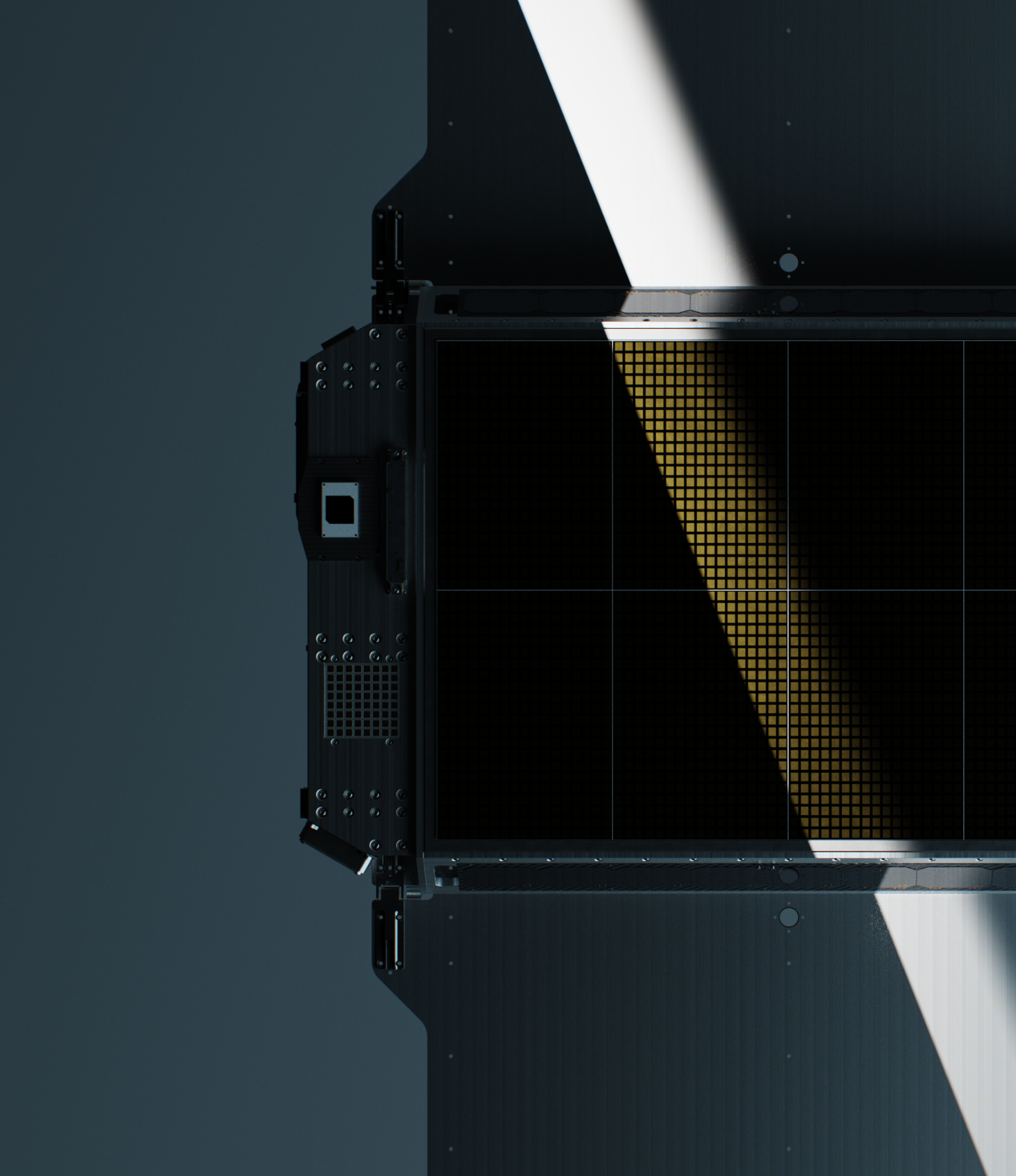
High-quality 3D imagery of the Earth has always been scarce and expensive. Legacy radar satellites can cost hundreds of millions of dollars each and are built like bespoke instruments.
The customers who need current, detailed maps of the ground have historically had two bad options: pay enormous sums for satellite tasking, where the highest bidder wins priority, or fly aircraft repeatedly over the same terrain. Autonomous-vehicle companies, for instance, have spent millions of dollars a week keeping high-definition maps current for just a handful of cities.
Array's answer is to change the supply side. By borrowing manufacturing techniques from consumer electronics and telecommunications - the industries that learned to produce complex radios by the hundred million - it aims to make radar payloads that are modular, compact, and cheap enough to fly in quantity. The company says its radar can deliver up to 100 times the power of legacy systems at roughly 1% of the cost.
To hold formation without burning fuel, Array made another counterintuitive choice: it removed the thrusters. "We delete the thruster systems entirely," Peterson has said. The satellites instead use the faint drag of the upper atmosphere to surf into position - fewer moving parts, fewer things to fail, and a longer working life in orbit.
The company operates across the radar value chain - from the sensor itself to finished 3D data.
Compact, lightweight, high-power radar payloads that are modular and easy to integrate onto third-party satellites and buses.
Distributed clusters that image a target from multiple angles at once - higher power, greater sensitivity, native 3D imaging, and real-time moving-target indication.
Continuously refreshed global elevation datasets with up to 10-centimeter resolution, sold as subscription data products for monitoring the physical world.
Dedicated radar satellite systems built and delivered for governments and operators that need their own sovereign space-based radar capability.
Array's own performance claims, shown as a rough visual - figures are company-stated and approximate.
*Figures are Array Labs' stated targets and claims, not independently verified performance.
Array makes money three ways, and the constellation is designed so early customers pay down the fixed cost while later ones ride high margins.
The first line is selling radar payloads to other satellite providers. The second is delivering dedicated - "sovereign" - satellite systems to governments and operators who want their own capability. The third is selling data products from Array's own constellation on a subscription basis, replacing the traditional model where imagery goes to whoever bids highest.
The customer list spans defense and commerce. Array has been selected for roughly half a dozen awards across the U.S. armed services and intelligence community, and reports nine digits in contracted commercial revenue from bookings. Its early commercial thesis centered on autonomous vehicles, logistics, and large technology companies that need current 3D maps of the world.
In the wider market, Array sits between the optical-imaging giants - Maxar and Planet - and a newer generation of radar startups such as Umbra, ICEYE, and Capella Space. What sets it apart is the geometry: where rivals fly single radar satellites producing 2D images, Array flies clusters that natively produce 3D. Its CEO frames the harder challenge as reach rather than technology: "First time founders care about product, second time founders care about distribution."
Array has raised about $35M since going through Y Combinator's S22 batch.
| Round | Amount | Date | Select Investors |
|---|---|---|---|
| Y Combinator (S22) | $500K | 2022 | Y Combinator |
| Seed | $5.0M | Oct 2022 | Seraphim Space, Agya Ventures |
| Additional financing | $10.0M | 2024 | Undisclosed |
| Series A | $20.0M | Jan 2026 | Catapult Ventures, Washington Harbour Partners, Kompas VC, Y Combinator, Maiora Ventures, SuperOrganism, Aera VC, Cultivation Capital, Clearance Ventures |
Andrew Peterson and Isaac Robledo start the company in the Bay Area to build distributed radar satellites.
Array joins YC's S22 batch and raises a $5M seed led by Seraphim Space and Agya Ventures.
TechCrunch profiles Array's plan to scan Earth from space to power 3D maps for autonomous vehicles.
Array raises further funding and advances its radar test hardware toward flight.
Array reveals its satellite design and first production cluster, wins a $1.25M mapping-algorithm contract, and doubles its team.
Array raises to scale manufacturing and prepare to launch the first formation-flying radar satellite cluster.
Array pairs aerospace veterans with semiconductor, telecom, and consumer-electronics talent from Qualcomm, Amazon, and Meta.
Co-founder and CEO. An aerospace engineer whose earlier remote-sensing work included contributions associated with the Vera Rubin Observatory, satellite constellation design, and high-resolution radar systems. Says he never planned to be a founder - "then I had an idea that was way too good."
Co-founder. Helped start Array in 2021 with the thesis that distributed, mass-manufactured radar could replace bespoke, monolithic satellites.
"If you continue to scale up an antenna to be larger and larger, it gets exponentially less efficient. But what if you recast the problem as scaling distributed systems?"
Andrew Peterson"We delete the thruster systems entirely."
Andrew Peterson"First time founders care about product, second time founders care about distribution."
Andrew Peterson"I never thought I'd start a company. I still don't introduce myself as an entrepreneur. But then I had an idea that was way too good."
Andrew PetersonSearch these sources for the latest talks, product reveals, and demos as they publish.