spatial-data
(4)
NavVis makes the site visit optional
A walk through a factory can become a place thousands of people visit from their desks. NavVis is betting that the valuable part of a scan begins after the scanner goes home.

The $1,100 Map Shop That Became the Operating System for Where
Esri began as a tiny land-use consultancy. Fifty-seven years later, its software helps cities find buried valves, retailers choose corners, and emergency teams see trouble before it spreads - while a difficult desktop transition tests the loyalty of the mapmakers who built their careers on it.

VertiGIS Turned the Map Into a Workbench - Now 5,300 Organizations Run Real-World Operations on It
Most maps tell you where something is. VertiGIS wants the map to assign the repair, validate the parcel, update the network, and tell the office what happened next.
Hover
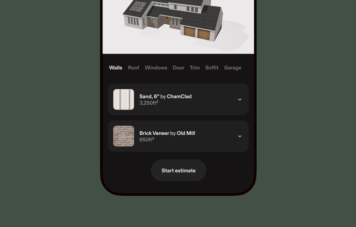
Hover is a San Francisco-based AI and computer vision company that turns smartphone photos into accurate, interactive 3D models of properties — complete with measurements, material takeoffs, and design visualization. Serving 300,000+ construction and insurance professionals, and trusted by 9 of the top 10 U.S. insurance carriers, Hover has digitally reconstructed over 22 billion square feet of property. Its platform compresses what used to be hours of manual estimation into minutes, enabling faster insurance claims, more accurate contractor bids, and immersive homeowner design experiences.