The hole was supposed to be routine. In the origin story GPRS tells about its founder, Matt Aston remembered a technician drilling into a grocery store floor and hitting an electrical line. The power went out. A small action had reached a much larger system. Years later, an advertisement for a ground penetrating radar scanner suggested a business: help the next person find the line before the drill does.
- GPRS finds buried utilities and hidden concrete hazards, then documents what it finds.
- Its buyers include contractors, architects, engineers, utilities, and facility owners.
- SiteMap keeps maps, scans, models, and inspection records available after the fieldwork.
That sequence explains the company better than a list of instruments. Construction brings people into contact with systems they cannot fully see. A concrete floor looks reassuringly solid. Underneath it might be reinforcement, a conduit, or a tensioned cable. The expensive question is whether the proposed hole and the hidden object occupy the same space.
A machine needs an interpreter
Aston founded GPRS in 2001. The company’s technology history describes one radar unit operating from the basement of a concrete cutting and coring business in Toledo. There was no established training school for this new private-sector application. Aston learned through trial and error, and the account says it took years to convince him that radar could sustain a business.
Here was the first obstacle: buying the instrument did not supply the judgment. Radar returns signals. Someone must interpret them. GPRS eventually made that distinction part of its operating system, using Subsurface Investigation Methodology, or SIM, to organize training, equipment choices, and repeatable field procedures.
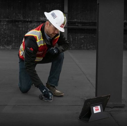
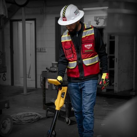
The preparation is unusually tangible. GPRS describes training spaces with a simulated gas station, underground storage tanks, buried utilities, and an elevator shaft containing difficult cable arrangements. Staff can encounter confusing conditions before meeting them on a customer’s schedule. For utility locating and concrete scanning, the published requirement is 320 hours of mentored fieldwork plus 80 classroom hours.
Published SIM training requirement for utility locating and concrete scanning.
First find it. Then keep it.
GPRS now combines private utility locating, concrete scanning, video pipe inspection, leak detection, and reality capture. Those services answer different questions. Radar helps investigate hidden objects. Electromagnetic locating follows detectable utility signals. Cameras inspect pipe interiors. Acoustic tools help pinpoint water leaks. A laser scanner measures visible surfaces.
That last distinction matters. A laser scan does not magically see through the floor. The useful move is combining complementary evidence. GPRS can capture markings from a subsurface investigation and place them within the same documentation workflow as the building around them. A designer can then consider the visible structure alongside the hidden infrastructure.
The June 2022 acquisition of TruePoint Laser Scanning expanded this aboveground work. Point clouds, CAD drawings, and building information models became part of a broader proposition: document existing conditions before changing them. A contractor planning a pipe route can check its relationship to existing features; an architect renovating a building can begin with measured geometry.
- 01InvestigateFind hidden features
- 02DocumentBuild maps and models
- 03ShareKeep the record usable
GPRS reports 2-4 millimeter accuracy for its laser measurements. That is a dimensional claim about a particular service. Its separately advertised 99.8%+ utility locating and concrete scanning accuracy is a company-reported performance figure. The two numbers describe different things, and neither makes every site equally easy to investigate.
The next crew needs the answer, too
Finding something solves today’s problem. Keeping the information accessible helps tomorrow’s team. SiteMap, GPRS’s cloud GIS platform and digital plan room, holds utility maps, drawings, models, and inspection records. Its role is practical: connect an item of site knowledge with the place and people that need it.
“all of the information stored in one location”
Jonathan Harris / Brasfield & Gorrie, in a SiteMap testimonial
The University of Toledo is one published example of this approach, using SiteMap to centralize infrastructure records. In March 2026, GPRS announced SiteMap 3.0, adding mobile augmented reality and My Dig Board, an excavation collaboration tool. The interface keeps moving closer to the person making the decision in the field.
What the invoice buys
The commercial model combines paid field services and software subscriptions. GPRS customers receive complimentary SiteMap Personal access; broader Project, Pro, and Team offerings address different workflows. Field pricing depends on location, scope, complexity, access, and requested deliverables. A scan and a finished BIM model are different purchases.
GPRS puts equipment purchases in context by citing roughly $14,000 to more than $100,000 for radar systems, before training. That is equipment cost, not a customer quote. Hiring the company buys access to people, instruments, interpretation, and agreed outputs. The economic test is whether that work reduces a project’s exposure to rework, damage, and delay.
For Turner Construction’s Denver Center for the Performing Arts work, GPRS describes scanning hundreds of proposed coring locations. It reports that coring proceeded without incident. This is the service in miniature: an investigation changes where someone can act, before the action becomes expensive.
The discipline travels better than the gadget
GPRS sits between specialist field contractors and construction information software. Its national network and in-house mapping team offer a connected route from investigation to deliverable. Roark became its majority investor in January 2025, with Kohlberg retaining a minority position. Acquisitions have continued to broaden the service footprint.
The constraints remain physical. Moisture and conductive soils can restrict radar penetration. Laser scanning needs sightlines. A stored record describes what was captured, and subsequent changes need documenting. GPRS also states that it does not provide engineering services. A model still needs the appropriate professional judgment around it.
The useful habit to copy is straightforward: verify with complementary tools, train people to interpret uncertain evidence, and make the result available to whoever arrives next. Before changing a building, give the people changing it a shared picture of what is already there.